Ordnance Survey

Ordnance Survey is the national mapping agency for Great Britain, renowned for its high-quality maps and innovative navigation tools. With a history spanning over 200 years, Ordnance Survey provides detailed topographic maps that cater to outdoor enthusiasts, professionals, and anyone seeking to explore the great outdoors. Whether you're hiking in the hills, cycling through the countryside, or planning a road trip, Ordnance Survey has the perfect mapping solution to guide you. Their products are trusted by millions for their accuracy and reliability, making them the go-to choice for anyone serious about navigation and exploration.
Ordnance Survey (OS) stands as the authoritative mapping agency for Great Britain, a beacon of precision and reliability in the world of cartography. Established in 1791, OS has evolved to become synonymous with high-quality mapping and navigation solutions that cater to a diverse range of users. From outdoor enthusiasts and hikers to professionals in various industries, Ordnance Survey offers a comprehensive suite of products designed to enhance your exploration experience.

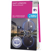
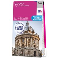
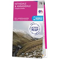
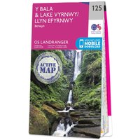
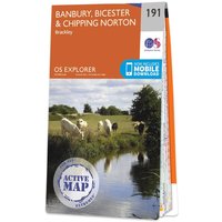
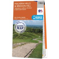
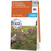
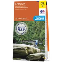
At the heart of Ordnance Survey's offerings are their detailed topographic maps, which provide an unparalleled level of detail about the terrain, landmarks, and features of the British landscape. These maps are meticulously crafted, incorporating a range of scales to suit different needs—from detailed city maps to expansive countryside coverage. Each map is designed to guide you through the intricacies of the outdoors, ensuring you never lose your way.

In addition to traditional paper maps, Ordnance Survey has embraced technology, providing a range of digital mapping solutions. Their mobile applications, such as OS Maps, allow users to access and download maps directly to their smartphones or tablets. This seamless integration of digital technology ensures that you have your maps on hand anytime, anywhere, enhancing your outdoor adventures. The OS Maps app also features route planning, live weather updates, and sharing capabilities, making it an indispensable tool for outdoor navigation.

Trust is paramount when it comes to navigation, and Ordnance Survey has built a reputation over the centuries as a trusted source for accurate mapping. Their commitment to quality is evident in every product they offer, which is why they are the preferred choice for professionals in fields such as construction, surveying, and emergency services. By using Ordnance Survey maps, these professionals can ensure their work is based on the most reliable data available.

For those who enjoy outdoor activities, Ordnance Survey’s products extend beyond maps. They offer a range of accessories, including compasses, guides, and outdoor equipment, making it easier for adventurers to prepare for their journeys. Whether you are planning a day hike or a multi-day expedition, Ordnance Survey provides the tools you need to navigate confidently and safely.

When comparing prices, Ordnance Survey positions itself as a premium provider of mapping solutions. While their products may be priced higher than some alternatives, the investment is justified by the unmatched accuracy and reliability they offer. For serious adventurers and professionals alike, the benefits of using Ordnance Survey maps greatly outweigh the costs.

Moreover, Ordnance Survey frequently updates its maps to reflect changes in the landscape, ensuring that you are always equipped with the most current information. This dedication to accuracy and detail is what sets Ordnance Survey apart from competitors, making it a trusted partner for anyone who values precision in navigation.

In summary, Ordnance Survey is more than just a mapping agency; it is a cornerstone of outdoor exploration in Great Britain. With a rich history, a commitment to quality, and a range of innovative products, OS is the go-to source for anyone looking to navigate the stunning landscapes of the UK. Whether you are an avid hiker, a professional in need of precise mapping, or simply someone who enjoys exploring the outdoors, Ordnance Survey has the right solutions to help you on your journey.
Books (847) Uncategorized (129) Gifts (16) Outdoor Adventure (5) Christmas Gifts (2) Women's Clothing (1)
Ordnance Survey The Complete Set of Guidebooks 706.65
Ordnance Survey The Complete Set of Pathfinder Guidebooks - England 488.42
Ordnance Survey The Complete Set of Short Walks Made Easy 214.94
Ordnance Survey The Complete Set of Short Walks Made Easy Guidebooks - England 143.82
Ordnance Survey The Complete Set of Pathfinder Guidebooks - Scotland 135.10
Ordnance Survey The Complete Set of Outstanding Walks Series 91.98
Ordnance Survey The Complete Set of Puzzle Books 67.96
Ordnance Survey The Complete Set of Pathfinder Guidebooks - Wales 62.35
Ordnance Survey OS Road map set - Britain Complete 51.14
Ordnance Survey OS Maps Premium 12 Month Subscription Gift Card 39.99
Ordnance Survey The Complete Set of Short Walks Made Easy Guidebooks - Wales 38.35
Ordnance Survey Lake District Walking Guidebook Set - OS Walking Guides 35.98
Ordnance Survey The Complete Set of Short Walks Made Easy Guidebooks - Scotland 32.76
UCO South Downs Walking Guidebook Set - OS Walking Guides 27.97
Ordnance Survey Outstanding Walks Wales (cymru) - OS Walking Guidebook 25.00
Ordnance Survey Outstanding Walks Lake District - Walking Guidebook 25.00
Ordnance Survey Outstanding Walks Scotland - OS Walking Guidebook 25.00
Ordnance Survey Apollo 11 Landing: Map of the Moon - Wall Map 24.99
Ordnance Survey Mars - Western Arabia Terra: Maps Of Mars - Flat Map - 1:400000 Scale 24.99
Ordnance Survey The Complete Set of Dog-friendly Walks Made Easy Guidebooks - OS Short Walks Made Easy 21.57
Ordnance Survey Epic British Walks - OS Walking Guidebook 19.99
Ordnance Survey Pathfinder 100 Outstanding British Walks - OS Guides 19.99
The Ordnance Survey Puzzle Tour of Britain Book 18.99
Ordnance Survey 13 Valleys of the English Lake District Map - 1 Inch To 1 Mile 1:40 000 Scale 18.50
Ordnance Survey Norfolk Walking Guidebook Set - OS Walking Guides 17.58
Uco Eryri (snowdonia) Walking Guidebook Set - OS Walking Guides 17.58
Ordnance Survey Isle of Wight Walking Guidebook Set - OS Walking Guides 17.58
Ordnance Survey New Forest Walking Guidebook Set - OS Walking Guides 17.58
Ordnance Survey Bannau Brycheiniog (brecon Beacons) Walking Guidebook Set - OS Walking Guides 17.58
Ordnance Survey North York Moors Walking Guidebook Set - OS Walking Guides 17.58
Ordnance Survey Cotswold Walking Guidebook Set - OS Walking Guides 17.58
Ordnance Survey Northumberland Walking Guidebook Set - OS Walking Guides 17.58
Ordnance Survey Puzzle Book: Legends & Landmarks - OS Puzzle Book 5 16.99
Ordnance Survey Journey Through Time Puzzle Book 16.99
The Ordnance Survey Maps Puzzle Book 16.99
UCO Cairngorms Walking Guidebook Set - OS Walking Guides 15.98
Ordnance Survey Cornwall Walking Guidebook Set - OS Walking Guides 15.98
Ordnance Survey Dorset's Jurassic Coast Walking Guidebook Set - OS Walking Guide 15.98
Ordnance Survey Peak District Walking Guidebook Set - OS Walking Guides 15.98
Ordnance Survey Yorkshire Dales Walking Guidebook Set - OS Walking Guides 15.98
Ordnance Survey South Downs Relief Map - A3 14.99
Ordnance Survey New Forest Relief Map - A3 14.99
Ordnance Survey Cairngorms Relief Map - A3 14.99
Ordnance Survey Loch Lomond & The Trossachs Relief Map - A3 14.99
Ordnance Survey The Broads Relief Map - A3 14.99
Ordnance Survey Northumberland Relief Map - A3 14.99
Ordnance Survey Exmoor Relief Map - A3 14.99
Ordnance Survey Yorkshire Dales Relief Map - A3 14.99
Ordnance Survey North York Moors Relief Map - A3 14.99
Ordnance Survey Pembrokeshire Coast Relief Map - A3 14.99
Ordnance Survey Dartmoor Relief Map - A4 14.99
Ordnance Survey Eryri (Snowdonia) Relief Map - A3 14.99
Ordnance Survey Lake District Relief Map - A4 14.99
Ordnance Survey Peak District Relief Map - A4 14.99
Ordnance Survey Great Britain's National Parks Relief Map 14.99
Ordnance Survey Great Britain's Islands Relief Map 14.99
Ordnance Survey Geological Map of the British Islands 1939 14.99
Ordnance Survey Great British Treasure Hunt Puzzle Book 14.99
Ordnance Survey Great British Travel Journal 14.99
Ordnance Survey OS Map of Maidstone & Royal Tunbridge Wells: Landranger 188 14.99
Ordnance Survey OS Map of Dorking & Reigate: Landranger 187 14.99
Ordnance Survey OS Map of Aldershot & Guildford: Landranger 186 - Weatherproof 14.99
Ordnance Survey OS Map of Winchester & Basingstoke: Landranger 185 14.99
Ordnance Survey OS Map of Salisbury & The Plain: Landranger 184 14.99
Ordnance Survey OS Map of Weston-super-mare: Landranger 182 14.99
Ordnance Survey OS Map of West London: Landranger 176 14.99
Ordnance Survey OS Map of Reading & Windsor: Landranger 175 14.99
Ordnance Survey OS Map of Newbury & Wantage: Landranger 174 14.99
Ordnance Survey OS Map of Bristol & Bath: Landranger 172 14.99
Ordnance Survey OS Map of Vale of Glamorgan West: Landranger 170 14.99
Ordnance Survey OS Map of Ipswich & The Naze: Landranger 169 14.99
Ordnance Survey OS Map of Colchester: Landranger 168 14.99
Ordnance Survey OS Map of Chelmsford: Landranger 167 14.99
Ordnance Survey OS Map of Luton & Hertford: Landranger 166 14.99
Ordnance Survey OS Map of Cheltenham & Cirencester: Landranger 163 14.99
Ordnance Survey OS Map of Tenby & Pembroke: Landranger 158 14.99
Ordnance Survey OS Map of St David's & Haverfordwest: Landranger 157 - Weatherproof 14.99
Ordnance Survey OS Map of Bedford & Huntingdon: Landranger 153 14.99
Ordnance Survey OS Map of Hereford & Leominster: Landranger 149 14.99
Ordnance Survey OS Map of Presteigne & Hay-on-wye: Landranger 148 14.99
Ordnance Survey OS Map of Taunton & Lyme Regis: Landranger 193 14.99
Ordnance Survey OS Map of Brighton & Lewes: Landranger 198 14.99
Ordnance Survey OS Map of Land's End & Isles of Scilly: Landranger 203 14.99
Ordnance Survey OS Map of Church Stretton & Ludlow: Landranger 137 14.99
Ordnance Survey OS Map of Newtown & Llanidloes: Landranger 136 14.99
Ordnance Survey OS Map of Snowdon (yr Wyddfa) - Caernarfon: Landranger 115 14.99
Ordnance Survey OS Map of Grimsby: Landranger 113 14.99
Ordnance Survey OS Map of Scarborough: Landranger 101 14.99
Ordnance Survey OS Map of Wensleydale & Upper Wharfedale: Landranger 98 14.99
Ordnance Survey OS Map of Kendal & Morecambe: Landranger 97 14.99
Ordnance Survey OS Map of Barrow-in-furness & South Lakeland: Landranger 96 14.99
Ordnance Survey OS Map of Isle of Man: Landranger 95 14.99
Ordnance Survey OS Map of Whitby & Esk Dale: Landranger 94 14.99
Ordnance Survey OS Map of Middlesbrough: Landranger 93 14.99
Ordnance Survey OS Map of Barnard Castle & Richmond: Landranger 92 14.99
Ordnance Survey OS Map of Appleby-in-westmorland: Landranger 91 14.99
Ordnance Survey OS Map of Penrith & Keswick: Landranger 90 14.99
Ordnance Survey OS Map of West Cumbria: Landranger 89 14.99
Ordnance Survey OS Map of Yeovil & Frome: Landranger 183 14.99
Ordnance Survey OS Map of Newcastle Upon Tyne Durham & Sunderland: Landranger 88 14.99
Ordnance Survey OS Map of Minehead & Brendon Hills: Landranger 181 14.99
Ordnance Survey OS Map of Hexham & Haltwhistle: Landranger 87 - Weatherproof 14.99
Ordnance Survey OS Map of Barnstaple & Ilfracombe: Landranger 180 14.99
Ordnance Survey OS Map of Canterbury & East Kent: Landranger 179 14.99
Ordnance Survey OS Map of Haltwhistle & Brampton: Landranger 86 - Weatherproof 14.99
Ordnance Survey OS Map of Thames Estuary: Landranger 178 14.99
Ordnance Survey OS Map of East London: Landranger 177 14.99
Ordnance Survey OS Map of Carlisle & Solway Firth: Landranger 85 14.99
Ordnance Survey OS Map of Dumfries & Castle Douglas: Landranger 84 14.99
Ordnance Survey OS Map of Swindon & Devizes: Landranger 173 14.99
Ordnance Survey OS Map of Newton Stewart & Kirkcudbright: Landranger 83 14.99
Ordnance Survey OS Map of Cardiff & Newport: Landranger 171 14.99
Ordnance Survey OS Map of Stranraer & Glenluce: Landranger 82 14.99
Ordnance Survey OS Map of Alnwick & Morpeth: Landranger 81 14.99
Ordnance Survey OS Map of Cheviot Hills & Kielder Water: Landranger 80 14.99
Ordnance Survey OS Map of Aylesbury & Leighton Buzzard: Landranger 165 14.99
Ordnance Survey OS Map of Hawick & Eskdale: Landranger 79 14.99
Ordnance Survey OS Map of Oxford: Landranger 164 14.99
Ordnance Survey OS Map of Nithsdale & Annandale: Landranger 78 14.99
Ordnance Survey OS Map of Gloucester & Forest of Dean: Landranger 162 14.99
Ordnance Survey OS Map of The Black Mountains: Landranger 161 14.99
Ordnance Survey OS Map of Dalmellington & New Galloway: Landranger 77 14.99
Ordnance Survey OS Waterproof Map of Bannau Brycheiniog (brecon Beacons): Landranger 160 14.99
Ordnance Survey OS Map of Swansea & Gower: Landranger 159 14.99
Ordnance Survey OS Map of Girvan: Landranger 76 14.99
Ordnance Survey OS Map of Berwick-upon-tweed, Holy Island & Wooler: Landranger 75 14.99
Ordnance Survey OS Map of Saxmundham, Aldeburgh & Southwold: Landranger 156 14.99
Ordnance Survey OS Map of Bury St Edmunds: Landranger 155 14.99
Ordnance Survey OS Map of Kelso & Coldstream: Landranger 74 14.99
Ordnance Survey OS Map of Cambridge & Newmarket: Landranger 154 14.99
Ordnance Survey OS Map of Peebles, Galashiels & Selkirk Map: Landranger 73 - Weatherproof - 1 Inch To 1 Mile 1:50 000 Scale 14.99
Ordnance Survey OS Map of Northampton & Milton Keynes: Landranger 152 14.99
Ordnance Survey OS Map of Stratford-upon-avon: Landranger 151 14.99
Ordnance Survey OS Map of Upper Clyde Valley: Landranger 72 14.99
Ordnance Survey OS Map of Worcester & The Malverns: Landranger 150 14.99
Ordnance Survey OS Map of Lanark & Upper Nithsdale: Landranger 71 14.99
Ordnance Survey OS Map of Elan Valley & Builth Wells: Landranger 147 14.99
Ordnance Survey OS Map of Ayr, Kilmarnock & Troon: Landranger 70 - Weatherproof 14.99
Ordnance Survey OS Map of Lampeter & Llandovery: Landranger 146 14.99
Ordnance Survey OS Map of Cardigan & Mynydd Preseli: Landranger 145 - Weatherproof 14.99
Ordnance Survey OS Map of Isle of Arran Landranger: Landranger 69 14.99
Ordnance Survey OS Map of Thetford & Diss: Landranger 144 14.99
Ordnance Survey OS Map of Ashford & Romney Marsh: Landranger 189 14.99
Ordnance Survey OS Map of South Kintyre & Campbeltown: Landranger 68 - Weatherproof 14.99
Ordnance Survey OS Map of Bude & Clovelly: Landranger 190 14.99
Ordnance Survey OS Map of Okehampton & North Dartmoor: Landranger 191 14.99
Ordnance Survey OS Map of Duns, Dunbar & Eyemouth: Landranger 67 - Weatherproof 14.99
Ordnance Survey OS Map of Exeter & Sidmouth: Landranger 192 14.99
Ordnance Survey OS Map of Edinburgh: Landranger 66 14.99
Ordnance Survey OS Map of Dorchester & Weymouth: Landranger 194 14.99
Ordnance Survey OS Map of Bournemouth & Purbeck: Landranger 195 14.99
Ordnance Survey OS Map of Falkirk & Linlithgow: Landranger 65 14.99
Ordnance Survey OS Map of The Solent & Isle of Wight: Landranger 196 14.99
Ordnance Survey OS Map of Chichester & the South Downs: Landranger 197 14.99
Ordnance Survey OS Map of Eastbourne & Hastings: Landranger 199 14.99
Ordnance Survey OS Map of Firth of Clyde: Landranger 63 14.99
Ordnance Survey OS Map of Newquay & Bodmin: Landranger 200 14.99
Ordnance Survey OS Map of Plymouth & Launceston: Landranger 201 - Weatherproof 14.99
Ordnance Survey OS Map of North Kintyre & Tarbert: Landranger 62 14.99
Ordnance Survey OS Map of Torbay & South Dartmoor: Landranger 202 14.99
Ordnance Survey OS Map of Jura & Colonsay: Landranger 61 - Weatherproof 14.99
Ordnance Survey OS Map of Truro & Falmouth: Landranger 204 14.99
Ordnance Survey OS Map of Ely & Wisbech: Landranger 143 14.99
Ordnance Survey OS Map of Islay: Landranger 60 14.99
Ordnance Survey OS Map of Peterborough -market Deeping & Chatteris: Landranger 142 14.99
Ordnance Survey OS Map of Kettering & Corby: Landranger 141 14.99
Ordnance Survey OS Map of St Andrews: Landranger 59 14.99
Ordnance Survey OS Map of Leicester: Landranger 140 14.99
Ordnance Survey OS Map of Birmingham & Wolverhampton: Landranger 139 14.99
Ordnance Survey OS Map of Perth & Alloa: Landranger 58 14.99
Ordnance Survey OS Map of Kidderminster & Wyre Forest: Landranger 138 14.99
Ordnance Survey OS Map of Stirling & The Trossachs: Landranger 57 14.99
Ordnance Survey OS Map of Aberystwyth & Machynlleth: Landranger 135 - Weatherproof 14.99
Ordnance Survey OS Map of Loch Lomond & Inveraray: Landranger 56 14.99
Ordnance Survey OS Map of Norwich & The Broads: Landranger 134 14.99
Ordnance Survey OS Map of North East Norfolk: Landranger 133 14.99
Ordnance Survey OS Map of Lochgilphead & Loch Awe: Landranger 55 14.99
Ordnance Survey OS Map of North West Norfolk: Landranger 132 14.99
Ordnance Survey OS Map of Boston & Spalding: Landranger 131 14.99
Ordnance Survey OS Map of Dundee & Montrose: Landranger 54 14.99
Ordnance Survey OS Map of Grantham: Landranger 130 - Weatherproof - 1 Inch To 1 Mile 1:50 000 Scale 14.99
Ordnance Survey OS Map of Nottingham & Loughborough: Landranger 129 14.99
Ordnance Survey OS Map of Blairgowrie & Forest of Alyth: Landranger 53 14.99
Ordnance Survey OS Map of Derby & Burton Upon Trent: Landranger 128 - Weatherproof 14.99
Ordnance Survey OS Map of Stafford & Telford: Landranger 127 14.99
Ordnance Survey OS Map of Pitlochry & Crieff: Landranger 52 14.99
Ordnance Survey OS Map of Shrewsbury & Oswestry: Landranger 126 14.99
Ordnance Survey OS Map of Bala & Lake Vyrnwy: Landranger 125 14.99
Ordnance Survey OS Map of Loch Tay & Glen Dochart: Landranger 51 14.99
Ordnance Survey OS Map of Porthmadog & Dolgellau: Landranger 124 14.99
Ordnance Survey OS Map of Lleyn Peninsula: Landranger 123 14.99
Ordnance Survey OS Map of Glen Orchy & Loch Etive: Landranger 50 14.99
Ordnance Survey OS Map of Skegness & Horncastle Map: Landranger 122 - Weatherproof - 1 Inch To 1 Mile 1:50 000 Scale 14.99
Ordnance Survey OS Map of Lincoln & Newark-on-trent: Landranger 121 14.99
Ordnance Survey OS Map of Oban & East Mull: Landranger 49 14.99
Ordnance Survey OS Map of Mansfield & Worksop: Landranger 120 14.99
Ordnance Survey OS Map of Buxton & Matlock: Landranger 119 14.99
Ordnance Survey OS Map of Iona & West Mull: Landranger 48 14.99
Ordnance Survey OS Map of Stoke-on-trent & Macclesfield: Landranger 118 14.99
Ordnance Survey OS Map of Chester & Wrexham: Landranger 117 14.99
Ordnance Survey OS Map of Tobermory & North Mull: Landranger 47 14.99
Ordnance Survey OS Map of Denbigh & Colwyn Bay: Landranger 116 14.99
Ordnance Survey OS Map of Coll & Tiree Landranger: Landranger 46 14.99
Ordnance Survey OS Map of Anglesey (ynys Môn): Landranger 114 14.99
Ordnance Survey OS Map of Stonehaven & Banchory: Landranger 45 14.99
Ordnance Survey OS Map of Scunthorpe & Gainsborough: Landranger 112 14.99
Ordnance Survey OS Map of Sheffield & Doncaster: Landranger 111 14.99
Ordnance Survey OS Map of Ballater & Glen Clova: Landranger 44 - Weatherproof 14.99
Ordnance Survey OS Map of Sheffield & Huddersfield: Landranger 110 14.99
Ordnance Survey OS Map of Manchester: Landranger 109 14.99
Ordnance Survey OS Map of Braemar & Blair Atholl: Landranger 43 14.99
Ordnance Survey OS Map of Liverpool: Landranger 108 14.99
Ordnance Survey OS Map of Kingston Upon Hull: Landranger 107 14.99
Ordnance Survey OS Map of Glen Garry & Loch Rannoch: Landranger 42 14.99
Ordnance Survey OS Map of Market Weighton: Landranger 106 14.99
Ordnance Survey OS Map of York & Selby: Landranger 105 14.99
Ordnance Survey OS Map of Ben Nevis: Landranger 41 14.99
Ordnance Survey OS Map of Leeds & Bradford: Landranger 104 14.99
Ordnance Survey OS Map of Blackburn & Burnley: Landranger 103 14.99
Ordnance Survey OS Map of Preston & Blackpool: Landranger 102 14.99
Ordnance Survey OS Map of Rùm, Eigg, Muck & Canna: Landranger 39 14.99
Ordnance Survey OS Map of Malton & Pickering: Landranger 100 14.99
Ordnance Survey OS Map of Northallerton & Ripon: Landranger 99 14.99
Ordnance Survey OS Map of Aberdeen: Landranger 38 14.99
Ordnance Survey OS Map of Strathdon & Alford: Landranger 37 14.99
Ordnance Survey OS Map of Grantown & Aviemore: Landranger 36 14.99
Ordnance Survey OS Map of Kingussie & Monadhliath Mountains: Landranger 35 14.99
Ordnance Survey OS Map of Fort Augustus: Landranger 34 14.99
Ordnance Survey OS Map of Loch Alsh, Glen Shiel & Loch Hourn: Landranger 33 14.99
Ordnance Survey OS Map of South Skye & Cuillin Hills: Landranger 32 14.99
Ordnance Survey OS Map of Barra & South Uist: Landranger 31 14.99
Ordnance Survey OS Map of Banff & Huntly: Landranger 29 14.99
Ordnance Survey OS Map of Elgin & Dufftown Map: Landranger 28 - Weatherproof - 1 Inch To 1 Mile 1:50 000 Scale 14.99
Ordnance Survey OS Map of Nairn & Forres: Landranger 27 - Weatherproof 14.99
Ordnance Survey OS Map of Inverness & Loch Ness: Landranger 26 14.99
Ordnance Survey OS Map of Glen Carron & Glen Affric: Landranger 25 14.99
Ordnance Survey OS Map of North Skye: Landranger 23 14.99
Ordnance Survey OS Map of Shetland - Unst, Yell & Fetlar: Explorer 470 14.99
Ordnance Survey OS Map of Shetland - Mainland North West: Explorer 469 14.99
Ordnance Survey OS Map of Shetland - Mainland North East: Explorer 468 14.99
Ordnance Survey OS Map of Shetland - Mainland Central: Explorer 467 14.99
Ordnance Survey OS Map of Shetland - Mainland South: Explorer 466 14.99
Ordnance Survey OS Map of Orkney - Sanday, Eday, North Ronaldsay & Stronsay: Explorer 465 14.99
Ordnance Survey OS Map of Orkney - Westray, Papa Westray, Rousay, Egilsay & Wyre: Explorer 464 14.99
Ordnance Survey OS Map of Orkney - West Mainland: Explorer 463 14.99
Ordnance Survey OS Map of Orkney - Hoy, South Walls & Flotta: Explorer 462 14.99
Ordnance Survey OS Map of Orkney - East Mainland: Explorer 461 14.99
Ordnance Survey OS Map of North Lewis: Explorer 460 14.99
Ordnance Survey OS Map of Central Lewis & Stornoway: Explorer 459 14.99
Ordnance Survey OS Map of West Lewis: Explorer 458 14.99
Ordnance Survey OS Map of South East Lewis: Explorer 457 - Weatherproof 14.99
Ordnance Survey OS Map of North Harris & Loch Seaforth: Explorer 456 14.99
Ordnance Survey OS Map of North Uist & Berneray: Explorer 454 14.99
Ordnance Survey OS Map of Benbecula & South Uist, Eriskay: Explorer 453 14.99
Ordnance Survey OS Map of Barra & Vatersay: Explorer 452 14.99
Ordnance Survey OS Map of Thurso & John o'Groats: Explorer 451 14.99
Ordnance Survey OS Map of Wick & The Flow Country: Explorer 450 14.99
Ordnance Survey OS Map of Strath Halladale & Strathy Point: Explorer 449 14.99
Ordnance Survey OS Map of Strath Naver & Loch Loyal: Explorer 448 14.99
Ordnance Survey OS Map of Ben Hope, Ben Loyal & Kyle of Tongue: Explorer 447 14.99
Ordnance Survey OS Map of Foinaven, Arkle, Kylesku & Scourie: Explorer 445 - Weatherproof 14.99
Ordnance Survey OS Map of Helmsdale & Strath of Kildonan Explorer: Explorer 444 14.99
Ordnance Survey OS Map of Ben Klibreck & Ben Armine: Explorer 443 14.99
Ordnance Survey OS Map of Assynt & Lochinver: Explorer 442 14.99
Ordnance Survey OS Map of Lairg, Bonar Bridge & Golspie: Explorer 441 14.99
Ordnance Survey OS Map of Glen Cassley & Oykel: Explorer 440 - Weatherproof 14.99
Ordnance Survey OS Map of Coigach & Summer Isles: Explorer 439 14.99
Ordnance Survey OS Map of Dornoch & Tain: Explorer 438 14.99
Ordnance Survey OS Map of Ben Wyvis & Strathpeffer: Explorer 437 14.99
Ordnance Survey OS Map of Newtown & Machynlleth: Explorer 215 - Weatherproof - 1 Inch To 1 Mile 1:25 000 Scale 14.99
Ordnance Survey OS Map of Builth Wells: Explorer 188 14.99
Ordnance Survey OS Map of Gravesend & Rochester: Explorer 163 14.99
Ordnance Survey OS Map of Reading: Explorer 159 14.99
Ordnance Survey OS Map of An Teallach & Slioch: Explorer 435 14.99
Ordnance Survey OS Map of Gairloch & Loch Ewe: Explorer 434 - Weatherproof 14.99
Ordnance Survey OS Map of Torridon - Beinn Eighe & Liathach: Explorer 433 14.99
Ordnance Survey OS Map of Black Isle: Explorer 432 14.99
Ordnance Survey OS Map of Loch Monar, Glen Cannich & Glen Strathfarrar: Explorer 430 14.99
Ordnance Survey OS Map of Kyle of Lochalsh, Plockton & Applecross: Explorer 428 14.99
Ordnance Survey OS Map of Peterhead & Fraserburgh: Explorer 427 14.99
Ordnance Survey OS Map of Banff, Macduff & Turriff: Explorer 426 14.99
Ordnance Survey OS Map of Huntly & Cullen: Explorer 425 14.99
Ordnance Survey OS Map of Buckie & Keith: Explorer 424 14.99
Ordnance Survey OS Map of Elgin, Forres & Lossiemouth: Explorer 423 14.99
Ordnance Survey OS Map of Nairn & Cawdor: Explorer 422 14.99
Ordnance Survey OS Map of Ellon & Inverurie: Explorer 421 14.99
Ordnance Survey OS Map of Monadhliath Mountains North & Strathdearn: Explorer 417 14.99
Ordnance Survey OS Map of Inverness, Loch Ness & Culloden: Explorer 416 14.99
Ordnance Survey OS Map of Glen Affric & Glen Moriston: Explorer 415 14.99
Ordnance Survey OS Map of Glen Shiel & Kintail Forest: Explorer 414 14.99
Ordnance Survey OS Map of Knoydart, Loch Hourn & Loch Duich: Explorer 413 14.99
Ordnance Survey OS Map of Skye - Sleat: Explorer 412 14.99
Ordnance Survey OS Map of Skye - Portree & Bracadale: Explorer 410 14.99
Ordnance Survey OS Map of Raasay, Rona & Scalpay: Explorer 409 14.99
Ordnance Survey OS Map of Skye - Trotternish & The Storr: Explorer 408 14.99
Ordnance Survey OS Map of Skye - Dunvegan: Explorer 407 14.99
Ordnance Survey OS Map of Aberdeen & Banchory: Explorer 406 14.99
Ordnance Survey OS Map of Loch Lochy & Glen Roy: Explorer 400 14.99
Ordnance Survey OS Map of Loch Morar & Mallaig: Explorer 398 14.99
Ordnance Survey OS Map of Rùm, Eigg, Muck, Canna & Sanday: Explorer 397 14.99
Ordnance Survey OS Map of Stonehaven, Inverbervie & Laurencekirk: Explorer 396 14.99
Ordnance Survey OS Map of Ben Nevis & Fort William: Explorer 392 14.99
Ordnance Survey OS Map of Ardnamurchan: Explorer 390 14.99
Ordnance Survey OS Map of Forfar, Brechin & Edzell: Explorer 389 14.99
Ordnance Survey OS Map of Rannoch Moor & Ben Alder: Explorer 385 14.99
Ordnance Survey OS Map of Morvern & Lochaline: Explorer 383 14.99
Ordnance Survey OS Map of Arbroath, Montrose & Carnoustie: Explorer 382 14.99
Ordnance Survey OS Map of Blairgowrie, Kirriemuir & Glamis: Explorer 381 14.99
Ordnance Survey OS Map of Dundee & Sidlaw Hills: Explorer 380 14.99
Ordnance Survey OS Map of Dunkeld, Aberfeldy & Glen Almond: Explorer 379 14.99
Ordnance Survey OS Map of Oban & North Lorn: Explorer 376 14.99
Ordnance Survey OS Map of Isle of Mull East: Explorer 375 14.99
Ordnance Survey OS Map of Isle of Mull North & Tobermory: Explorer 374 14.99
Ordnance Survey OS Map of Iona, Staffa & Ross of Mull: Explorer 373 14.99
Ordnance Survey OS Map of Coll & Tiree Explorer: Explorer 372 14.99
Ordnance Survey OS Map of St Andrews & East Fife: Explorer 371 14.99
Ordnance Survey OS Map of Glenrothes North, Falkland & Lomond Hills: Explorer 370 14.99
Ordnance Survey OS Map of Perth & Kinross: Explorer 369 14.99
Ordnance Survey OS Map of Dunfermline, Kirkcaldy & Glenrothes South: Explorer 367 14.99
Ordnance Survey OS Map of Stirling & Ochil Hills West: Explorer 366 14.99
Ordnance Survey OS Map of Cowal West & Isle of Bute: Explorer 362 14.99
Ordnance Survey OS Map of Isle of Arran: Explorer 361 14.99
Ordnance Survey OS Map of Oban, Kerrera & Loch Melfort: Explorer 359 14.99
Ordnance Survey OS Map of Lochgilphead & Knapdale North: Explorer 358 14.99
Ordnance Survey OS Map of Kintyre North: Explorer 357 14.99
Ordnance Survey OS Map of Kintyre South: Explorer 356 - Weatherproof 14.99
Ordnance Survey OS Map of Colonsay & Oronsay: Explorer 354 14.99
Ordnance Survey OS Map of Islay North: Explorer 353 14.99
Ordnance Survey OS Map of Islay South: Explorer 352 14.99
Ordnance Survey OS Map of Edinburgh Musselburgh & Queensferry: Explorer 350 14.99
Ordnance Survey OS Map of Falkirk, Cumbernauld & Livingston: Explorer 349 14.99
Ordnance Survey OS Map of Berwick-upon-tweed: Explorer 346 14.99
Ordnance Survey OS Map of Lammermuir Hills: Explorer 345 14.99
Ordnance Survey OS Map of Pentland Hills: Explorer 344 14.99
Ordnance Survey OS Map of Motherwell & Coatbridge: Explorer 343 14.99
Ordnance Survey OS Map of Greenock Largs & Millport: Explorer 341 - Weatherproof 14.99
Ordnance Survey OS Map of Holy Island & Bamburgh: Explorer 340 14.99
Ordnance Survey OS Map of Kelso, Coldstream & Lower Tweed Valley: Explorer 339 14.99
Ordnance Survey OS Map of Galashiels, Selkirk & Melrose: Explorer 338 14.99
Ordnance Survey OS Map of Peebles & Innerleithen: Explorer 337 14.99
Ordnance Survey OS Map of Biggar & Broughton: Explorer 336 14.99
Ordnance Survey OS Map of Lanark & Tinto Hills: Explorer 335 14.99
Ordnance Survey OS Map of East Kilbride, Galston & Darvel: Explorer 334 14.99
Ordnance Survey OS Map of Kilmarnock & Irvine: Explorer 333 - Weatherproof 14.99
Ordnance Survey OS Map of Alnwick & Amble: Explorer 332 14.99
Ordnance Survey OS Map of Teviotdale South: Explorer 331 14.99
Ordnance Survey OS Map of Moffat & St Mary's Loch: Explorer 330 - Weatherproof 14.99
Ordnance Survey OS Map of Lowther Hills, Sanquhar & Leadhills: Explorer 329 14.99
Ordnance Survey OS Map of Sanquhar & New Cumnock: Explorer 328 14.99
Ordnance Survey OS Map of Cumnock & Dalmellington: Explorer 327 14.99
Ordnance Survey OS Map of Ayr & Troon: Explorer 326 14.99
Ordnance Survey OS Map of Morpeth & Blyth: Explorer 325 14.99
Ordnance Survey OS Map of Liddesdale & Kershope Forest: Explorer 324 14.99
Ordnance Survey OS Map of Eskdale and Castle O'er Forest: Explorer 323 14.99
Ordnance Survey OS Map of Nithsdale & Dumfries: Explorer 321 14.99
Ordnance Survey OS Map of Castle Douglas, Loch Ken & New Galloway: Explorer 320 14.99
Ordnance Survey OS Map of Galloway Forest Park South: Explorer 319 14.99
Ordnance Survey OS Map of Galloway Forest Park North: Explorer 318 14.99
Ordnance Survey OS Map of Ballantrae, Barr & Barrhill: Explorer 317 14.99
Ordnance Survey OS Map of Carlisle: Explorer 315 14.99
Ordnance Survey OS Map of Solway Firth: Explorer 314 14.99
Ordnance Survey OS Map of Dumfries & Dalbeattie: Explorer 313 14.99
Ordnance Survey OS Map of Wigtown, Whithorn & The Machars: Explorer 311 14.99
Ordnance Survey OS Map of Glenluce & Kirkcowan: Explorer 310 14.99
Ordnance Survey OS Map of Stranraer & The Rhins: Explorer 309 14.99
Ordnance Survey OS Map of Durham & Sunderland: Explorer 308 14.99
Ordnance Survey OS Map of Consett & Derwent Reservoir: Explorer 307 14.99
Ordnance Survey OS Map of Middlesbrough & Hartlepool: Explorer 306 14.99
Ordnance Survey OS Map of Bishop Auckland: Explorer 305 14.99
Ordnance Survey OS Map of Whitehaven & Workington: Explorer 303 14.99
Ordnance Survey OS Map of Northallerton & Thirsk: Explorer 302 14.99
Ordnance Survey OS Map of Scarborough, Bridlington & Flamborough Head: Explorer 301 14.99
Ordnance Survey OS Map of Howardian Hills & Malton: Explorer 300 14.99
Ordnance Survey OS Map of Ripon & Boroughbridge: Explorer 299 14.99
Ordnance Survey OS Map of Nidderdale: Explorer 298 14.99
Ordnance Survey OS Map of Lower Wharfedale & Washburn Valley: Explorer 297 14.99
Ordnance Survey OS Map of Lancaster, Morecambe & Fleetwood: Explorer 296 14.99
Ordnance Survey OS Map of Bridlington, Driffield & Hornsea: Explorer 295 14.99
Ordnance Survey OS Map of Market Weighton & Yorkshire Wolds Central: Explorer 294 14.99
Ordnance Survey OS Map of Withernsea & Spurn Head: Explorer 292 14.99
Ordnance Survey OS Map of Goole & Gilberdyke: Explorer 291 14.99
Ordnance Survey OS Map of York: Explorer 290 14.99
Ordnance Survey OS Map of Leeds: Explorer 289 14.99
Ordnance Survey OS Map of Bradford & Huddersfield: Explorer 288 14.99
Ordnance Survey OS Map of West Pennine Moors: Explorer 287 14.99
Ordnance Survey OS Map of Blackpool & Preston: Explorer 286 14.99
Ordnance Survey OS Map of Southport & Chorley: Explorer 285 14.99
Ordnance Survey OS Map of Grimsby, Cleethorpes & Immingham: Explorer 284 14.99
Ordnance Survey OS Map of Louth & Mablethorpe Map: Explorer 283 - Weatherproof - 1 Inch To 1 Mile 1:25 000 Scale 14.99
Ordnance Survey OS Map of Lincolnshire Wolds North: Explorer 282 14.99
Ordnance Survey OS Map of Ancholme Valley: Explorer 281 14.99
Ordnance Survey OS Map of Isle Of Axholme: Explorer 280 - Weatherproof 14.99
Ordnance Survey OS Map of Doncaster: Explorer 279 14.99
Ordnance Survey OS Map of Sheffield & Barnsley: Explorer 278 14.99
Ordnance Survey OS Map of Manchester & Salford: Explorer 277 14.99
Ordnance Survey OS Map of Bolton Central, Wigan & Warrington: Explorer 276 14.99
Ordnance Survey OS Map of Liverpool St Helens, Widnes & Runcorn: Explorer 275 14.99
Ordnance Survey OS Map of Skegness, Alford & Spilsby: Explorer 274 14.99
Ordnance Survey OS Map of Lincolnshire Wolds South: Explorer 273 14.99
Ordnance Survey OS Map of Lincoln: Explorer 272 14.99
Ordnance Survey OS Map of Newark-on-trent: Explorer 271 14.99
Ordnance Survey OS Map of Sherwood Forest: Explorer 270 14.99
Ordnance Survey OS Map of Chesterfield & Alfreton: Explorer 269 14.99
Ordnance Survey OS Map of Wilmslow, Macclesfield & Congleton: Explorer 268 14.99
Ordnance Survey OS Map of Northwich & Delamere Forest: Explorer 267 14.99
Ordnance Survey OS Map of Wirral & Chester: Explorer 266 14.99
Ordnance Survey OS Map of Clwydian Range: Explorer 265 14.99
Ordnance Survey OS Map of Vale of Clwyd: Explorer 264 14.99
Ordnance Survey OS Map of Anglesey East: Explorer 263 14.99
Ordnance Survey OS Map of Anglesey West: Explorer 262 14.99
Ordnance Survey OS Map of Boston: Explorer 261 14.99
Ordnance Survey OS Map of Nottingham: Explorer 260 14.99
Ordnance Survey OS Map of Derby: Explorer 259 14.99
Ordnance Survey OS Map of Crewe & Nantwich: Explorer 257 14.99
Ordnance Survey OS Map of Stoke-on-trent & Newcastle-under-lyme: Explorer 258 14.99
Ordnance Survey OS Map of Wrexham & Llangollen: Explorer 256 14.99
Ordnance Survey OS Map of Llangollen & Berwyn: Explorer 255 14.99
Ordnance Survey OS Map of Lleyn Peninsula East: Explorer 254 14.99
Ordnance Survey OS Map of Lleyn Peninsula West: Explorer 253 - Weatherproof 14.99
Ordnance Survey OS Map of Norfolk Coast East: Explorer 252 14.99
Ordnance Survey OS Map of Norfolk Coast Central: Explorer 251 14.99
Ordnance Survey OS Map of Norfolk Coast West: Explorer 250 14.99
Ordnance Survey OS Map of Spalding & Holbeach: Explorer 249 - Weatherproof 14.99
Ordnance Survey OS Map of Bourne & Heckington: Explorer 248 14.99
Ordnance Survey OS Map of Grantham Bottesford & Colsterworth: Explorer 247 - Weatherproof 14.99
Ordnance Survey OS Map of Loughborough: Explorer 246 14.99
Ordnance Survey OS Map of The National Forest: Explorer 245 14.99
Ordnance Survey OS Map of Cannock Chase & Chasewater: Explorer 244 14.99
Ordnance Survey OS Map of Market Drayton: Explorer 243 14.99
Ordnance Survey OS Map of Telford, Ironbridge & The Wrekin: Explorer 242 14.99
Ordnance Survey OS Map of Shrewsbury: Explorer 241 14.99
Ordnance Survey OS Map of Oswestry: Explorer 240 14.99
Ordnance Survey OS Map of Lake Vyrnwy & Llanfyllin: Explorer 239 14.99
Ordnance Survey OS Map of Dereham & Aylsham: Explorer 238 14.99
Ordnance Survey OS Map of Norwich: Explorer 237 14.99
Ordnance Survey OS Map of King's Lynn, Downham Market & Swaffham: Explorer 236 14.99
Ordnance Survey OS Map of Wisbech & Peterborough North: Explorer 235 14.99
Ordnance Survey OS Map of Rutland Water: Explorer 234 14.99
Ordnance Survey OS Map of Leicester & Hinckley: Explorer 233 14.99
Ordnance Survey OS Map of Nuneaton & Tamworth: Explorer 232 14.99
Ordnance Survey OS Map of Southwold & Bungay: Explorer 231 14.99
Ordnance Survey OS Map of Diss & Harleston: Explorer 230 14.99
Ordnance Survey OS Map of Thetford Forest in The Brecks: Explorer 229 14.99
Ordnance Survey OS Map of March & Ely: Explorer 228 14.99
Ordnance Survey OS Map of Peterborough: Explorer 227 14.99
Ordnance Survey OS Map of Ely & Newmarket: Explorer 226 - Weatherproof 14.99
Ordnance Survey OS Map of Huntingdon & St Ives: Explorer 225 14.99
Ordnance Survey OS Map of Corby, Kettering & Wellingborough: Explorer 224 14.99
Ordnance Survey OS Map of Northampton & Market Harborough: Explorer 223 14.99
Ordnance Survey OS Map of Rugby & Daventry: Explorer 222 14.99
Ordnance Survey OS Map of Coventry & Warwick: Explorer 221 14.99
Ordnance Survey OS Map of Wolverhampton & Dudley: Explorer 219 14.99
Ordnance Survey OS Map of Kidderminster & Wyre Forest Bridgnorth: Explorer 218 14.99
Ordnance Survey OS Map of The Long Mynd & Wenlock Edge: Explorer 217 14.99
Ordnance Survey OS Map of Welshpool & Montgomery: Explorer 216 14.99
Ordnance Survey OS Map of Llanidloes & Newtown: Explorer 214 - Weatherproof 14.99
Ordnance Survey OS Map of Aberystwyth & Cwm Rheidol: Explorer 213 14.99
Ordnance Survey OS Map of Woodbridge & Saxmundham: Explorer 212 14.99
Ordnance Survey OS Map of Bury St Edmunds & Stowmarket: Explorer 211 14.99
Ordnance Survey OS Map of Newmarket & Haverhill: Explorer 210 14.99
Ordnance Survey OS Map of Cambridge: Explorer 209 14.99
Ordnance Survey OS Map of Bedford & St Neots: Explorer 208 14.99
Ordnance Survey OS Map of Newport Pagnell & Northampton South: Explorer 207 14.99
Ordnance Survey OS Map of Edge Hill & Fenny Compton: Explorer 206 14.99
Ordnance Survey OS Map of Stratford-upon-avon & Evesham: Explorer 205 14.99
Ordnance Survey OS Map of Worcester & Droitwich Spa: Explorer 204 14.99
Ordnance Survey OS Map of Leominster & Bromyard: Explorer 202 14.99
Ordnance Survey OS Map of Ludlow: Explorer 203 14.99
Ordnance Survey OS Map of Knighton & Presteigne: Explorer 201 14.99
Ordnance Survey OS Map of Llandrindod Wells & Elan Valley: Explorer 200 14.99
Ordnance Survey OS Map of Lampeter: Explorer 199 14.99
Ordnance Survey OS Map of Cardigan & New Quay: Explorer 198 14.99
Ordnance Survey OS Map of Ipswich, Felixstowe & Harwich: Explorer 197 14.99
Ordnance Survey OS Map of Sudbury, Hadleigh & Dedham Vale: Explorer 196 14.99
Ordnance Survey OS Map of Braintree & Saffron Walden: Explorer 195 14.99
Ordnance Survey OS Map of Hertford & Bishop's Stortford: Explorer 194 14.99
Ordnance Survey OS Map of Luton & Stevenage: Explorer 193 14.99
Ordnance Survey OS Map of Buckingham & Milton Keynes: Explorer 192 14.99
Ordnance Survey OS Map of Banbury, Bicester & Chipping Norton: Explorer 191 14.99
Ordnance Survey OS Map of Malvern Hills & Bredon Hill: Explorer 190 - Weatherproof 14.99
Ordnance Survey OS Map of Hereford & Ross-on-Wye: Explorer 189 - Weatherproof 14.99
Ordnance Survey OS Map of Llandovery: Explorer 187 - Weatherproof 14.99
Ordnance Survey OS Map of Llandeilo & Brechfa Forest: Explorer 186 - Weatherproof 14.99
Ordnance Survey OS Map of Newcastle Emlyn: Explorer 185 14.99
Ordnance Survey OS Map of Colchester Harwich & Clacton-on-Sea: Explorer 184 - Weatherproof 14.99
Ordnance Survey OS Map of Chelmsford & The Rodings: Explorer 183 - Weatherproof 14.99
Ordnance Survey OS Map of St Albans & Hatfield: Explorer 182 14.99
Ordnance Survey OS Map of Chiltern Hills North: Explorer 181 - Weatherproof 14.99
Ordnance Survey OS Map of Oxford - Witney & Woodstock: Explorer 180 - Weatherproof 14.99
Ordnance Survey OS Map of Gloucester, Cheltenham & Stroud: Explorer 179 - Weatherproof 14.99
Ordnance Survey OS Map of Llanelli & Ammanford: Explorer 178 14.99
Ordnance Survey OS Map of Carmarthen & Kidwelly: Explorer 177 - Weatherproof 14.99
Ordnance Survey OS Map of Blackwater Estuary: Explorer 176 14.99
Ordnance Survey OS Map of Southend-on-Sea & Basildon: Explorer 175 - Weatherproof 14.99
Ordnance Survey OS Map of Epping Forest & Lee Valley: Explorer 174 - Weatherproof 14.99
Ordnance Survey OS Map of Chiltern Hills East: Explorer 172 - Weatherproof 14.99
Ordnance Survey OS Map of Chiltern Hills West: Explorer 171 - Weatherproof 14.99
Ordnance Survey OS Map of Abingdon, Wantage & Vale of White Horse: Explorer 170 - Weatherproof 14.99
Ordnance Survey OS Map of Cirencester & Swindon: Explorer 169 - Weatherproof 14.99
Ordnance Survey OS Map of Stroud, Tetbury & Malmesbury: Explorer 168 - Weatherproof 14.99
Ordnance Survey OS Map of Thornbury, Dursley & Yate: Explorer 167 - Weatherproof 14.99
Ordnance Survey OS Map of Rhondda & Merthyr Tydfil: Explorer 166 - Weatherproof 14.99
Ordnance Survey OS Map of Swansea: Explorer 165 - Weatherproof 14.99
Ordnance Survey OS Map of Gower: Explorer 164 - Weatherproof 14.99
Ordnance Survey OS Map of Greenwich and Gravesend: Explorer 162 14.99
Ordnance Survey OS Map of London South: Explorer 161 - Weatherproof 14.99
Ordnance Survey OS Map of Windsor, Weybridge & Bracknell: Explorer 160 - Weatherproof 14.99
Ordnance Survey OS Map of Newbury & Hungerford: Explorer 158 - Weatherproof 14.99
Ordnance Survey OS Map of Marlborough & Savernake Forest: Explorer 157 - Weatherproof 14.99
Ordnance Survey OS Map of Chippenham & Bradford-On-Avon: Explorer 156 - Weatherproof 14.99
Ordnance Survey OS Map of Bristol & Bath Keynsham & Marshfield: Explorer 155 - 1 Inch To 1 Mile 1:63 360 Scale 14.99
Ordnance Survey OS Map of Bristol West & Portishead: Explorer 154 - Weatherproof 14.99
Ordnance Survey OS Map of Weston-Super-Mare & Bleadon Hill: Explorer 153 - Weatherproof 14.99
Ordnance Survey OS Map of Newport & Pontypool: Explorer 152 - Weatherproof 14.99
Ordnance Survey OS Map of Cardiff & Bridgend: Explorer 151 - Weatherproof 14.99
Ordnance Survey OS Map of Canterbury & The Isle Of Thanet: Explorer 150 - Weatherproof 14.99
Ordnance Survey OS Map of Sittingbourne & Faversham: Explorer 149 - Weatherproof 14.99
Ordnance Survey OS Map of Dover, Folkestone & Hythe: Explorer 138 - Weatherproof 14.99
Ordnance Survey OS Map of Maidstone & The Medway Towns: Explorer 148 - Weatherproof 14.99
Ordnance Survey OS Map of Sevenoaks & Tonbridge: Explorer 147 - Weatherproof 14.99
Ordnance Survey OS Map of Dorking, Box Hill & Reigate: Explorer 146 - Weatherproof 14.99
Ordnance Survey OS Map of Guildford & Farnham: Explorer 145 - Weatherproof 14.99
Ordnance Survey OS Map of Basingstoke: Explorer 144 - Waterproof 14.99
Ordnance Survey OS Map of Warminster & Trowbridge: Explorer 143 14.99
Ordnance Survey OS Map of Shepton Mallet & Mendip Hills East: Explorer 142 - Weatherproof 14.99
Ordnance Survey OS Map of Cheddar Gorge & Mendip Hills West: Explorer 141 - Weatherproof 14.99
Ordnance Survey OS Map of Quantock Hills & Bridgwater: Explorer 140 - Weatherproof 14.99
Ordnance Survey OS Map of Bideford, Ilfracombe & Barnstaple: Explorer 139 - 1 Inch To 1 Mile 1:63 360 Scale 14.99
Ordnance Survey OS Map of Ashford: Explorer 137 - Weatherproof 14.99
Ordnance Survey OS Map of High Weald: Explorer 136 - Weatherproof 14.99
Ordnance Survey OS Map of Ashdown Forest: Explorer 135 14.99
Ordnance Survey OS Map of Romsey, Andover & Test Valley: Explorer 131 14.99
Ordnance Survey OS Map of Salisbury & Stonehenge: Explorer 130 14.99
Ordnance Survey OS Map of Yeovil & Sherborne: Explorer 129 14.99
Ordnance Survey OS Map of Taunton & Blackdown Hills: Explorer 128 14.99
Ordnance Survey OS Map of South Molton & Chulmleigh: Explorer 127 14.99
Ordnance Survey OS Map of Clovelly & Hartland: Explorer 126 14.99
Ordnance Survey OS Map of Romney Marsh: Explorer 125 14.99
Ordnance Survey OS Map of Hastings & Bexhill: Explorer 124 14.99
Ordnance Survey OS Map of Shaftesbury & Cranborne Chase: Explorer 118 14.99
Ordnance Survey OS Map of Cerne Abbas & Bere Regis: Explorer 117 14.99
Ordnance Survey OS Map of Lyme Regis & Bridport: Explorer 116 14.99
Ordnance Survey OS Map of Exmouth & Sidmouth: Explorer 115 14.99
Ordnance Survey OS Map of Exeter & the Exe Valley: Explorer 114 14.99
Ordnance Survey OS Map of Okehampton: Explorer 113 14.99
Ordnance Survey OS Map of Launceston & Holsworthy: Explorer 112 14.99
Ordnance Survey OS Map of Bude, Boscastle & Tintagel: Explorer 111 14.99
Ordnance Survey OS Map of Bodmin Moor: Explorer 109 14.99
Ordnance Survey OS Map of Lower Tamar Valley & Plymouth: Explorer 108 14.99
Ordnance Survey OS Map of St Austell & Liskeard: Explorer 107 14.99
Ordnance Survey OS Map of Newquay & Padstow: Explorer 106 14.99
Ordnance Survey OS Map of Falmouth & Mevagissey: Explorer 105 14.99
Ordnance Survey OS Map of Redruth & St Agnes: Explorer 104 14.99
Ordnance Survey OS Map of The Lizard: Explorer 103 14.99
Ordnance Survey OS Map of Land's End: Explorer 102 14.99
Ordnance Survey OS Map of Isles Of Scilly: Explorer 101 - Weatherproof 14.99
Ordnance Survey OS Map of Wye Valley & Forest of Dean: Explorer OL14 14.99
Ordnance Survey OS Map of Purbeck and South Dorset: Explorer OL15 14.99
Ordnance Survey OS Map of Yr Wyddfa (Snowdon) : Explorer OL17 - Weatherproof 14.99
Ordnance Survey OS Map of Harlech, Porthmadog & Y Bala: Explorer OL18 - Weatherproof 14.99
Ordnance Survey OS Map of South Devon: Explorer OL20 - Weatherproof 14.99
Ordnance Survey OS Map of New Forest: Explorer OL22 - Weatherproof 14.99
Ordnance Survey OS Map of Cadair Idris & Bala Lake: Explorer OL23 - Weatherproof 14.99
Ordnance Survey OS Map of The Peak District - White Peak Area: Explorer OL24 - Weatherproof 14.99
Ordnance Survey OS Map of Eastbourne & Beachy Head: Explorer OL25 - Weatherproof 14.99
Ordnance Survey OS Map of North York Moors - Western Area: Explorer OL26 - Weatherproof 14.99
Ordnance Survey OS Map of North York Moors - Eastern Area: Explorer OL27 - Weatherproof 14.99
Ordnance Survey OS Map of Dartmoor: Explorer OL28 - Weatherproof 14.99
Ordnance Survey OS Map of Isle Wight: Explorer OL29 - Weatherproof 14.99
Ordnance Survey OS Map of Yorkshire Dales - Northern & Central Area: Explorer OL30 - Weatherproof 14.99
Ordnance Survey OS Map of North Pennines: Explorer OL31 - Weatherproof 14.99
Ordnance Survey OS Map of Winchester: Explorer OL32 - Weatherproof 14.99
Ordnance Survey OS Map of Haslemere & Petersfield: Explorer OL33 - Weatherproof 14.99
Ordnance Survey OS Map of Crawley & Horsham: Explorer OL34 - Weatherproof 14.99
Ordnance Survey OS Map of North Pembrokeshire: Explorer OL35 - Weatherproof 14.99
Ordnance Survey OS Map of Brecon Beacons National Park (Eastern Area): Explorer OL13 - Waterproof 14.99
Ordnance Survey OS Map of Brecon Beacons National Park (Western Area): Explorer OL12 - Waterproof 14.99
Ordnance Survey OS Map of Exmoor: Explorer OL9 - Waterproof 14.99
Ordnance Survey OS Map of South Pembrokeshire: Explorer OL36 14.99
Ordnance Survey OS Map of Cowal East: Explorer OL37 14.99
Ordnance Survey OS Map of Loch Lomond South: Explorer OL38 - Waterproof 14.99
Ordnance Survey OS Map of Loch Lomond North: Explorer OL39 - Waterproof 14.99
Ordnance Survey OS Map of Grantown-on-Spey & Hills Cromdale: Explorer OL61 - Waterproof 14.99
Ordnance Survey OS Map of Lochindorb, Grantown-on-Spey & Carrbridge: Explorer OL60 - Waterproof 14.99
Ordnance Survey OS Map of Aboyne, Alford & Strathdon: Explorer OL59 - Waterproof 14.99
Ordnance Survey OS Map of Cairn Gorm & Aviemore: Explorer OL57 - Waterproof 14.99
Ordnance Survey OS Map of Badenoch & Upper Strathspey: Explorer OL56 14.99
Ordnance Survey OS Map of Loch Laggan & Creag Meagaidh: Explorer OL55 - Waterproof 14.99
Ordnance Survey OS Map of Lochnagar, Glen Muick & Clova: Explorer OL53 - Waterproof 14.99
Ordnance Survey OS Map of Glen Shee & Braemar: Explorer OL52 - Waterproof 14.99
Ordnance Survey OS Map of Ben Alder, Loch Ericht & Laggan: Explorer OL50 - Waterproof 14.99
Ordnance Survey OS Map of Pitlochry & Loch Tummel: Explorer OL49 - Waterproof 14.99
Ordnance Survey OS Map of Ben Lawers & Glen Lyon: Explorer OL48 - Waterproof 14.99
Ordnance Survey OS Map of The Trossachs: Explorer OL46 - Waterproof 14.99
Ordnance Survey OS Map of The Cotswolds: Explorer OL45 14.99
Ordnance Survey OS Map of Torquay & Dawlish: Explorer OL44 - Weatherproof 14.99
Ordnance Survey OS Map of The Lake District: South-eastern Area: Explorer OL7 14.99
Ordnance Survey OS Map of Hadrian's Wall: Explorer OL43 14.99
Ordnance Survey OS Map of The Lake District: South-western Area: Explorer OL6 14.99
Ordnance Survey OS Map of Kielder Water & Forest: Explorer OL42 14.99
Ordnance Survey OS Map of Forest of Bowland: Explorer OL41 14.99
Ordnance Survey OS Map of The Broads: Explorer OL40 14.99
Ordnance Survey OS Map of Coreen Hills & Glenlivet: Explorer OL62 14.99
Ordnance Survey OS Map of The Lake District: North-eastern Area: Explorer OL5 14.99
Ordnance Survey OS Map of The Lake District: North-western Area: Explorer OL4 14.99
Ordnance Survey OS Map of Yorkshire Dales - Southern & Western Area: Explorer OL2 14.99
Ordnance Survey OS Map of The Peak District - Dark Peak Area: Explorer OL1 14.99
Ordnance Survey Historical Complete Map Set 14.38
Pathfinder Greater Manchester Walking Guidebook - OS Pathfinder Guides 12.99
Ordnance Survey Pathfinder Isle of Wight Walking Guidebook - OS Guides 12.99
Ordnance Survey Pathfinder North Yorkshire: Accessible Walks for All - OS Guides 12.99
Ordnance Survey Pathfinder Northumberland Walking Guidebook - OS Guides 87 12.99
Ordnance Survey Pathfinder Scottish Borders Walking Guidebook - OS Guides 88 12.99
Ordnance Survey Pathfinder Lake District & Cumbria: Accessible Walks for All - OS Guides 86 12.99
Ordnance Survey Pathfinder Outer Hebrides Walking Guidebook, 1:25000 Scale - OS Guides 85 12.99
Ordnance Survey Pathfinder Anglesey, LLeyn and Eryri (Snowdonia) Walking Guidebook - OS Guides 78 12.99
Ordnance Survey Pathfinder Dee Valley, Clwydian Hills and North East Wales Walking Guidebook - OS Guides 79 12.99
Ordnance Survey Pathfinder Wiltshire Walking Guidebook - OS Guides 77 12.99
Pathfinder Somerset and the Mendips - Pathfinder Guidebook 76 12.99
Ordnance Survey Pathfinder North Coast 500 and Northern Highlands Walking Guidebook - OS Guides 83 12.99
Pathfinder Walks in Orkney & Shetland - Pathfinder Guidebook 82 12.99
Ordnance Survey Pathfinder Berkshire, Buckinghamshire and Oxfordshire Walking Guidebook - OS Guides 84 12.99
Pathfinder Walks in Staffordshire - Pathfinder Guidebook 81 12.99
Pathfinder Walks in Shropshire - Pathfinder Guidebook 80 12.99
Ordnance Survey Kids' Adventure Book 12.99
Ordnance Survey Pathfinder Navigation Skills For Walkers - OS Guides 12.99
Pathfinder Walks in North and Mid Devon - Pathfinder Guidebook 68 12.99
Ordnance Survey Pathfinder Walks in South West England's Coast Guidebook 69 12.99
Ordnance Survey Pathfinder The Home Counties From London By Train - OS Guides 72 12.99
Pathfinder High Fells of Lakeland - Pathfinder Mountain Walks Guidebook 12.99
Ordnance Survey Pathfinder Walks in West Sussex & South Downs Guidebook 66 12.99
Ordnance Survey Pathfinder Snowdonia - OS Guides 10 12.99
Ordnance Survey Pathfinder South Downs National Park & East Sussex - OS Guides 67 12.99
Ordnance Survey Pathfinder More Peak District - OS Guides 73 12.99
Ordnance Survey Pathfinder Walks in Yorkshire Dales Guidebook 15 12.99
Ordnance Survey Pathfinder Surrey - OS Guides 65 12.99
Ordnance Survey Pathfinder Aberdeen & Royal Deeside Walking Guidebook - OS Guides 46 12.99
Ordnance Survey Pathfinder Walks in Brecon Beacons Guidebook 18 12.99
Ordnance Survey Pathfinder Walks in Cambridgeshire & the Fens Guidebook 51 12.99
Ordnance Survey Pathfinder Walks in Gower, Swansea & Cardiff Guidebook 55 12.99
Ordnance Survey Pathfinder Cheshire Walking Guidebook - OS Guides 42 12.99
Ordnance Survey Pathfinder Thames Valley & Chilterns Walking Guidebook - OS Guides 25 12.99
Ordnance Survey Pathfinder The Cotswolds - OS Guides 6 12.99
Ordnance Survey Pathfinder Essex - OS Guides 44 12.99
Ordnance Survey Pathfinder Edinburgh, Pentlands And Lothians - OS Guides 47 12.99
Ordnance Survey Pathfinder Walks in Loch Ness and Inverness Guidebook 30 12.99
Ordnance Survey Pathfinder Short Walks in Hertfordshire & Bedfordshire Guidebook 32 12.99
Ordnance Survey Pathfinder Walks in New Forest, Hampshire & South Downs Guidebook 12 12.99
Ordnance Survey Pathfinder Lincolnshire & The Wolds - OS Guides 50 12.99
Ordnance Survey Pathfinder Walks in Mid Wales Guidebook 41 12.99
Ordnance Survey Pathfinder Isle Of Skye - OS Guides 3 12.99
Ordnance Survey Pathfinder Walks in South Pennines Guidebook 64 12.99
Ordnance Survey Pathfinder Vale Of York & Yorkshire Wolds - OS Guides 49 12.99
Ordnance Survey Pathfinder Walks in Oban, Mull & Kintyre Guidebook 31 12.99
Pathfinder Walks in Perthshire, Angus & Fife - Pathfinder Guidebook 27 12.99
Ordnance Survey Walks in The Malverns to Warwickshire - Guidebook 74 12.99
Ordnance Survey Pathfinder Dumfries & Galloway Guidebook 19 12.99
Ordnance Survey Pathfinder Fort William & Glen Coe - OS Guides 7 12.99
Ordnance Survey Pathfinder Lancashire - OS Guides 53 12.99
Ordnance Survey Pathfinder Norfolk - OS Guides 45 12.99
Ordnance Survey Pathfinder Sherwood Forest & The East Midlands - OS Guides 20 12.99
Ordnance Survey Pathfinder South Devon & Dartmoor - OS Guides 1 12.99
Pathfinder Walks in Suffolk - Pathfinder Guidebook 48 12.99
Ordnance Survey Pathfinder Walks in Wye Valley & the Forest of Dean Guidebook 29 12.99
Pathfinder Walks in Durham, North Pennines and Tyne & Wear - Pathfinder Guidebook 39 12.99
Ordnance Survey Pathfinder Walks in Exmoor & the Quantocks Guidebook 9 12.99
Ordnance Survey Pathfinder North York Moors Walking Guidebook - OS Guides 28 12.99
Pathfinder More Lake District Walks Guidebook 22 12.99
Ordnance Survey Pathfinder Walks in Dartmoor Guidebook 26 12.99
Ordnance Survey Pathfinder Pembrokeshire & Carmarthenshire Walking Guidebook - OS Guides 34 12.99
Ordnance Survey Pathfinder Walks in Cairngorms Guidebook 4 12.99
Pathfinder Walks in Lake District - Pathfinder Guidebook 60 12.99
Ordnance Survey Pathfinder Walks in Loch Lomond, The Trossach & Stirling Guidebook 12.99
Pathfinder Walks in Kent - Pathfinder Guidebook 8 12.99
Pathfinder Walks in Dorset - Pathfinder Guidebook 11 12.99
Ordnance Survey Pathfinder Walks in Peak District Guidebook 63 12.99
Ordnance Survey Pathfinder Cornwall Walking Guidebook - OS Guides 5 12.99
Ordnance Survey Dinas-mawddwy 1896-1904 - Historical Reproduction Map - 1 Inch To 1 Mile 1:63 360 Scale 11.99
Ordnance Survey Lizard 1896-1904 - Historical Reproduction Map - 1 Inch To 1 Mile 1:63 360 Scale 11.99
Ordnance Survey Minginish 1896-1904 - Historical Reproduction Map - 1 Inch To 1 Mile 1:63 360 Scale 11.99
Ordnance Survey Lochcarron 1896-1904 - Historical Reproduction Map - 1 Inch To 1 Mile 1:63 360 Scale 11.99
Ordnance Survey Epping 1896-1904 - Historical Reproduction Map - 1 Inch To 1 Mile 1:63 360 Scale 11.99
Ordnance Survey Hay 1896-1904 - Historical Reproduction Map - 1 Inch To 1 Mile 1:63 360 Scale 11.99
Ordnance Survey Saffron Walden 1896-1904 - Historical Reproduction Map 11.99
Ordnance Survey Church Stretton 1896-1904 - Historical Reproduction Map - 1 Inch To 1 Mile 1:63 360 Scale 11.99
Ordnance Survey Devizes 1896-1904 - Historical Reproduction Map - 1 Inch To 1 Mile 1:63 360 Scale 11.99
Ordnance Survey Pateley Bridge 1896-1904 - Historical Reproduction Map - 1 Inch To 1 Mile 1:63 360 Scale 11.99
Ordnance Survey Dover (a) 1896-1904 11.99
Ordnance Survey Rudha Hunish 1896-1904 - Historical Reproduction Map - 1 Inch To 1 Mile 1:63 360 Scale 11.99
Ordnance Survey Shrewsbury 1896-1904 - Historical Reproduction Map - 1 Inch To 1 Mile 1:63 360 Scale 11.99
Ordnance Survey Sidmouth 1896-1904 Historic Map 11.99
Ordnance Survey The Cheviot or Alwinton 1896-1904 - Historical Reproduction Map - 1 Inch To 1 Mile 1:63 360 Scale 11.99
Ordnance Survey Gairloch 1896-1904 - Historical Reproduction Map - 1 Inch To 1 Mile 1:63 360 Scale 11.99
Ordnance Survey Knighton 1896-1904 - Historical Reproduction Map - 1 Inch To 1 Mile 1:63 360 Scale 11.99
Ordnance Survey Hougary 1896-1904 - Historical Reproduction Map - 1 Inch To 1 Mile 1:63 360 Scale 11.99
Ordnance Survey Guisborough 1896-1904 - Historical Reproduction Map - 1 Inch To 1 Mile 1:63 360 Scale 11.99
Ordnance Survey Arran South 1896-1904 - Historical Reproduction Map - 1 Inch To 1 Mile 1:63 360 Scale 11.99
Ordnance Survey Hastings 1896-1904 Historic Map 11.99
Ordnance Survey Alston 1896-1904 - Historical Reproduction Map - 1 Inch To 1 Mile 1:63 360 Scale 11.99
Ordnance Survey Hitchin 1896-1904 - Historical Reproduction Map - 1 Inch To 1 Mile 1:63 360 Scale 11.99
Ordnance Survey Sunderland 1896-1904 - Historical Reproduction Map 11.99
Ordnance Survey Stamford 1896-1904 - Historical Reproduction Map - 1 Inch To 1 Mile 1:63 360 Scale 11.99
Ordnance Survey Rhayader 1896-1904 - Historical Reproduction Map 11.99
Ordnance Survey Swanage 1896-1904 - Historical Reproduction Map - 1 Inch To 1 Mile 1:63 360 Scale 11.99
Ordnance Survey Ludlow 1896-1904 - Historical Reproduction Map - 1 Inch To 1 Mile 1:63 360 Scale 11.99
Ordnance Survey Kirkcudbright 1896-1904 - Historical Reproduction Map - 1 Inch To 1 Mile 1:63 360 Scale 11.99
Ordnance Survey Welshpool 1896-1904 - Historical Reproduction Map - 1 Inch To 1 Mile 1:63 360 Scale 11.99
Ordnance Survey Dartmoor Forest 1896-1904 11.99
Ordnance Survey Folkestone 1896-1904 11.99
Ordnance Survey Northampton 1896-1904 - Historical Reproduction Map - 1 Inch To 1 Mile 1:63 360 Scale 11.99
Ordnance Survey Land's End 1896-1904 11.99
Ordnance Survey Bournemouth 1896-1904 - Historical Reproduction Map - 1 Inch To 1 Mile 1:63 360 Scale 11.99
Ordnance Survey Tunbridge Wells 1896-1904 - Historical Reproduction Map - 1 Inch To 1 Mile 1:63 360 Scale 11.99
Ordnance Survey Aberystwyth 1896-1904 - Historical Reproduction Map - 1 Inch To 1 Mile 1:63 360 Scale 11.99
Ordnance Survey Hamilton 1896-1904 - Historical Reproduction Map - 1 Inch To 1 Mile 1:63 360 Scale 11.99
Ordnance Survey Lampeter 1896-1904 - Historical Reproduction Map -  1 Inch To 1 Mile 1:63 360 Scale 11.99
Ordnance Survey North Berwick 1896-1904 - Historical Reproduction Map - 1 Inch To Mile 1:63 360 Scale 11.99
Ordnance Survey Boscastle 1896-1904 11.99
Ordnance Survey Scarp 1896-1904 - Historical Reproduction Map - 1 Inch To Mile 1:63 360 Scale 11.99
Ordnance Survey Stonehaven 1896-1904 - Historical Reproduction Map - 1 Inch To Mile 1:63 360 Scale 11.99
Ordnance Survey Fishguard 1896-1904, - Historical Reproduction Map - 1 Inch To Mile 1:63 360 Scale 11.99
Ordnance Survey Llangranog 1896-1904 - Historical Reproduction Map - 1 Inch To Mile 1:63 360 Scale 11.99
Ordnance Survey Ramsey 1896-1904 - Historical Reproduction Map - 1 Inch To Mile 1:63 360 Scale 11.99
Ordnance Survey Ringwood 1896-1904 - Historical Reproduction Map - 1 Inch To 1 Mile 1:63 360 Scale 11.99
Ordnance Survey Newquay 1896-1904 - Historical Reproduction Map - 1 Inch To 1 Mile 1:63 360 Scale 11.99
Ordnance Survey Great Driffield 1896-1904 - Historical Reproduction Map - 1 Inch To Mile 1:63 360 Scale 11.99
Ordnance Survey Bodmin 1896-1904 11.99
Ordnance Survey Coventry 1896-1904 - Historical Reproduction Map 11.99
Ordnance Survey Nairn 1896-1904 - Historical Reproduction Map 11.99
Ordnance Survey Kilmarnock 1896-1904 - Historical Reproduction Map - 1 Inch To Mile 1:63 360 Scale 11.99
Ordnance Survey Ammanford 1896-1904 - Historical Reproduction Map - 1 Inch To Mile 1:63 360 Scale 11.99
Ordnance Survey Alness 1896-1904 - Historical Reproduction Map - 1 Inch To Mile 1:63 360 Scale 11.99
Ordnance Survey Swaffham 1896-1904 - Historical Reproduction Map - 1 Inch To Mile 1:63 360 Scale 11.99
Ordnance Survey Aldershot 1896-1904 - Historical Reproduction Map - 1 Inch To Mile 1:63 360 Scale 11.99
Ordnance Survey Aberayron 1896-1904 - Historical Reproduction Map - Inch To Mile 1:63 360 Scale 11.99
Ordnance Survey Bradford 1896-1904 - Historical Reproduction Map 11.99
Ordnance Survey Kelso 1896-1904 - Historical Reproduction Map - 1:63 360 Scale 11.99
Ordnance Survey Beverley 1896-1904 - Historical Reproduction Map - 1 Inch To 1 Mile 1:63 360 Scale 11.99
Ordnance Survey Peterhead 1896-1904 - Historical Reproduction Map - 1 Inch To Mile 1:63 360 Scale 11.99
Ordnance Survey Inverness 1896-1904 - Historical Reproduction Map - 1 Inch To Mile 1:63 360 Scale 11.99
Ordnance Survey Alnwick 1896-1904 - Historical Reproduction Map - 1 Inch To 1 Mile 1:63 360 Scale 11.99
Ordnance Survey Kirkby Lonsdale 1896-1904 - Historical Reproduction Map - 1 Inch To Mile 1:63 360 Scale 11.99
Ordnance Survey Wolverhampton 1896-1904 - Historical Reproduction Map - 1 Inch To Mile 1:63 360 Scale 11.99
Ordnance Survey Bridgend 1896-1904 11.99
Ordnance Survey Ben Nevis 1896-1904 - Historical Reproduction Map - 1 Inch To 1 Mile 1:63 360 Scale 11.99
Ordnance Survey Banbury 1896-1904 - Historical Reproduction Map 11.99
Ordnance Survey Hungerford 1896-1904 - Historical Reproduction Map 11.99
Ordnance Survey Lewes 1896-1904 - Historical Reproduction Map 11.99
Ordnance Survey Fareham 1896-1904 - Historical Reproduction Map - 1:50 000 Scale 11.99
Ordnance Survey Glenelg 1896-1904 - Historical Reproduction Map 11.99
Ordnance Survey Yell 1896-1904 - Historical Reproduction Map - 1 Inch To 1 Mile 1:63 360 Scale 11.99
Ordnance Survey Blair Atholl 1896-1904 - Historical Reproduction Map - 1 Inch To 1 Mile 1:63 360 Scale 11.99
Ordnance Survey Newport 1896-1904 - Historical Reproduction Map - 1 Inch To 1 Mile 1:63 360 Scale 11.99
Ordnance Survey Moffat 1896-1904 - Historical Reproduction Map - 1 Inch To 1 Mile 1:63 360 Scale 11.99
Ordnance Survey Norwich 1896-1904 - Historical Reproduction Map - 1 Inch To 1 Mile 1:63 360 Scale 11.99
Ordnance Survey Silloth 1896-1904 - Historical Reproduction Map - 1 Inch To 1 Mile 1:63 360 Scale 11.99
Ordnance Survey Eddystone Rocks 1896-1904 - Historical Reproduction Map - 1:50 000 Scale 11.99
Ordnance Survey Ivybridge 1896-1904 - Historical Reproduction Map - 1:50 000 Scale 11.99
Ordnance Survey Builth Wells 1896-1904 - Historical Reproduction Map - 1 Inch To 1 Mile 1:63 360 Scale 11.99
Ordnance Survey Tobermory 1896-1904 - Historical Reproduction Map - 1 Inch To 1 Mile 1:63 360 Scale 11.99
Ordnance Survey Rannoch 1896-1904 - Historical Reproduction Map - 1 Inch To 1 Mile 1:63 360 Scale 11.99
Ordnance Survey Stratford on Avon 1896-1904 - Historical Reproduction Map - 1 Inch To 1 Mile 1:63 360 Scale 11.99
Ordnance Survey Foula 1896-1904 - Historical Reproduction Map 11.99
Ordnance Survey Keswick 1896-1904 - Historical Reproduction Map 11.99
Ordnance Survey Scarborough 1896-1904 - Historical Reproduction Map - 1 Inch To 1 Mile 1:63 360 Scale 11.99
Ordnance Survey Grantown on Spey 1896-1904 - Historical Reproduction Map - 1 Inch To Mile 1:63 360 Scale 11.99
Ordnance Survey Market Harborough 1896-1904 Historic Map 11.99
Ordnance Survey Durham 1896-1904 - Historical Reproduction Map 11.99
Ordnance Survey Saxmundham 1896-1904 - Historical Reproduction Map 11.99
Ordnance Survey Ross 1896-1904 - Historical Reproduction Map - 1 Inch To 1 Mile 1:63 360 Scale 11.99
Ordnance Survey Whalsey 1896-1904 - Historical Reproduction Map 11.99
Ordnance Survey Barmouth 1896-1904 - Historical Reproduction Map - 1 Inch To 1 Mile 1:63 360 Scale 11.99
Ordnance Survey Whitehaven 1896-1904 - Historical Reproduction Map - 1 Inch To 1 Mile 1:63 360 Scale 11.99
Ordnance Survey Maxwelltown 1896-1904 - Historical Reproduction Map - 1 Inch To 1 Mile 1:63 360 Scale 11.99
Ordnance Survey Rothesay 1896-1904 - Historical Reproduction Map - 1 Inch To 1 Mile 1:63 360 Scale 11.99
Ordnance Survey Bury St Edmunds 1896-1904 - Historical Reproduction Map - 1 Inch To 1 Mile 1:63 360 Scale 11.99
Ordnance Survey Worthing 1896-1904 - Historical Reproduction Map 11.99
Ordnance Survey Marlborough 1896-1904 - Historical Reproduction Map 11.99
Ordnance Survey Okehampton 1896-1904 - Historical Reproduction Map 11.99
Ordnance Survey Penrith 1896-1904 - Historical Reproduction Map 11.99
Ordnance Survey Wigtown 1896-1904 - Historical Reproduction Map - 1 Inch To 1 Mile 1:63 360 Scale 11.99
Ordnance Survey Dartford 1896-1904 - Historical Reproduction Map 11.99
Ordnance Survey Chichester 1896-1904 - Historical Reproduction Map 11.99
Ordnance Survey Wincanton 1896-1904 - Historical Reproduction Map - 1 Inch To 1 Mile 1:63 360 Scale 11.99
Ordnance Survey Isles of Scilly 1896-1904 - Historical Reproduction Map - 1 Inch To Mile 1:63 360 Scale 11.99
Ordnance Survey Stranraer 1896-1904 - Historical Reproduction Map 11.99
Ordnance Survey Tiree 1896-1904 - Historical Reproduction Map - 1 Inch To 1 Mile 1:63 360 Scale 11.99
Ordnance Survey Bowmore 1896-1904 - Historical Reproduction Map - 1 Inch To 1 Mile 1:63 360 Scale 11.99
Ordnance Survey Kendal 1896-1904 - Historical Reproduction Map - 1 Inch To 1 Mile 1:63 360 Scale 11.99
Ordnance Survey Canterbury 1896-1904 - Historical Reproduction Map 11.99
Ordnance Survey Harrogate 1896-1904 - Historical Reproduction Map 11.99
Ordnance Survey Lichfield 1896-1904 - Historical Reproduction Map 11.99
Ordnance Survey Perth 1896-1904 - Historical Reproduction Map 11.99
Ordnance Survey Brightlingsea 1896-1904 - Historical Reproduction Map - 1 Inch To 1 Mile 1:63 360 Scale 11.99
Ordnance Survey Lancaster 1896-1904 Historic Map 11.99
Ordnance Survey Leicester 1896-1904 - Historical Reproduction Map 11.99
Ordnance Survey Coll 1896-1904 - Historical Reproduction Map - 1 Inch To 1 Mile 1:63 360 Scale 11.99
Ordnance Survey Plymouth 1896-1904 Historic Map 11.99
Ordnance Survey Lundy Island 1896-1904 - Historical Reproduction Map 11.99
Ordnance Survey Balmoral 1896-1904 - Historical Reproduction Map 11.99
Ordnance Survey Dudley 1896-1904 - Historical Reproduction Map 11.99
Ordnance Survey Shaftesbury 1896-1904 - Historical Reproduction Map 11.99
Ordnance Survey Applecross 1896-1904 - Historical Reproduction Map - 1 Inch To 1 Mile 1:63 360 Scale 11.99
Ordnance Survey Milford 1896-1904 - Historical Reproduction Map 11.99
Ordnance Survey Monach 1896-1904 - Historical Reproduction Map - 1 Inch To Mile 1:63 360 Scale 11.99
Ordnance Survey Pickering 1896-1904 - Historical Reproduction Map 11.99
Ordnance Survey Exeter 1896-1904 Historic Map 11.99
Ordnance Survey Wells 1896-1904 - Historical Reproduction Map - 1 Inch To 1 Mile 1:63 360 Scale 11.99
Ordnance Survey Wellington 1896-1904 - Historical Reproduction Map 11.99
Ordnance Survey Salisbury 1896-1904 Historic Map 11.99
Ordnance Survey Torquay 1896-1904 - Historical Reproduction Map 11.99
Ordnance Survey Loch Eil 1896-1904 - Historical Reproduction Map - 1 Inch To 1 Mile 1:63 360 Scale 11.99
Ordnance Survey Haslemere 1896-1904 - Historical Reproduction Map 11.99
Ordnance Survey Benholm 1896-1904 - Historical Reproduction Map 11.99
Ordnance Survey Eye 1896-1904 - Historical Reproduction Map 11.99
Ordnance Survey Fraserburgh 1896-1904 - Historical Reproduction Map 11.99
Ordnance Survey Inveraray 1896-1904 - Historical Reproduction Map - 1 Inch To 1 Mile 1:63 360 Scale 11.99
Ordnance Survey Kettering 1896-1904 - Historical Reproduction Map - 1 Inch To 1 Mile 1:63 360 Scale 11.99
Ordnance Survey Brighton 1896-1904 - Historical Reproduction Map 11.99
Ordnance Survey Annan 1896-1904 - Historical Reproduction Map - 1 Inch To 1 Mile 1:63 360 Scale 11.99
Ordnance Survey Mevagissey 1896-1904 - Historical Reproduction Map 11.99
Ordnance Survey Eastbourne 1896-1904 - Historical Reproduction Map 11.99
Ordnance Survey Fort Augustus 1896-1904 - Historical Reproduction Map 11.99
Ordnance Survey Ford 1896-1904 - Historical Reproduction Map - 1 Inch To 1 Mile 1:63 360 Scale 11.99
Ordnance Survey Rothes 1896-1904 - Historical Reproduction Map - 1 Inch To 1 Mile 1:63 360 Scale 11.99
Ordnance Survey Swindon 1896-1904 - Historical Reproduction Map 11.99
Ordnance Survey Bideford 1896-1904 - Historical Reproduction Map 11.99
Ordnance Survey Chepstow 1896-1904 - Historical Reproduction Map 11.99
Ordnance Survey Glasgow 1896-1904 - Historical Reproduction Map 11.99
Ordnance Survey Eyemouth 1896-1904 - Historical Reproduction Map - 1 Inch To 1 Mile 1:63 360 Scale 11.99
Ordnance Survey Felixstowe 1896-1904 - Historical Reproduction Map 11.99
Ordnance Survey Richmond 1896-1904 - Historical Reproduction Map 11.99
Ordnance Survey Lowestoft 1896-1904 - Historical Reproduction Map 11.99
Ordnance Survey Sanquhar 1896-1904 - Historical Reproduction Map 11.99
Ordnance Survey Talgarth 1896-1904 - Historical Reproduction Map 11.99
Ordnance Survey Morebattle 1896-1904 - Historical Reproduction Map  1 Inch To 1 Mile 1:63 360 Scale 11.99
Ordnance Survey Dulverton 1896-1904 - Historical Reproduction Map 11.99
Ordnance Survey Aberdeen 1896-1904 - Historical Reproduction Map 11.99
Ordnance Survey Faversham 1896-1904 - Historical Reproduction Map 11.99
Ordnance Survey Worms Head 1896-1904 - Historical Reproduction Map 11.99
Ordnance Survey Abingdon 1896-1904 - Historical Reproduction Map - 1 Inch To Mile 1:63 360 Scale 11.99
Ordnance Survey Cockermouth 1896-1904 - Historical Reproduction Map - 1 Inch To 1 Mile 1:63 360 Scale 11.99
Ordnance Survey Kinross 1896-1904 - Historical Reproduction Map - 1 Inch To 1 Mile 1:63 360 Scale 11.99
Ordnance Survey Elgin 1896-1904 - Historical Reproduction Map - 1 Inch To 1 Mile 1:63 360 Scale 11.99
Ordnance Survey Bridlington 1896-1904 - Historical Reproduction Map - 1 Inch To 1 Mile 1:63 360 Scale 11.99
Ordnance Survey Foulness 1896-1904 - Historical Reproduction Map 11.99
Ordnance Survey Chatham 1896-1904 - Historical Reproduction Map 11.99
Ordnance Survey Wisbech 1896-1904 - Historical Reproduction Map - 1 Inch To 1 Mile 1:63 360 Scale 11.99
Ordnance Survey Colchester 1896-1904 - Historical Reproduction Map 11.99
Ordnance Survey Portsmouth 1896-1904 - Reproduction Map 11.99
Ordnance Survey Basingstoke 1896-1904 - Historical Reproduction Map - 1 Inch To 1 Mile 1:63 360 Scale 11.99
Ordnance Survey Sudbury 1896-1904 - Historical Reproduction Map - 1 Inch To 1 Mile 1:63 360 Scale 11.99
Ordnance Survey Ventnor 1896-1904 - Historical Reproduction Map 11.99
Ordnance Survey Pontypridd 1896-1904 - Historical Reproduction Map 11.99
Ordnance Survey Minehead 1896-1904 - Historical Reproduction Map - 1 Inch To Mile 1:63 360 Scale 11.99
Ordnance Survey Bude Bay 1896-1904 - Historical Reproduction Map 11.99
Ordnance Survey Dover 1896-1904 - Historical Reproduction Map - 1 Inch To 1 Mile 1:63 360 Scale 11.99
Ordnance Survey Sollas 1896-1904 - Historical Reproduction Map - 1 Inch To 1 Mile 1:63 360 Scale 11.99
Ordnance Survey Yeovil 1896-1904 - Historical Reproduction Map 11.99
Ordnance Survey Leighton Buzzard 1896-1904 - Historical Reproduction Map 11.99
Ordnance Survey Glastonbury 1896-1904 11.99
Ordnance Survey Kingsbridge 1896-1904 - Historical Reproduction Map 11.99
Ordnance Survey Llanilar 1896-1904 11.99
Ordnance Survey Windsor 1896-1904 - Historical Reproduction Map 11.99
Ordnance Survey Tewkesbury 1896-1904 11.99
Ordnance Survey Hillswick 1896-1904 - Historical Reproduction Map - 1 Inch To 1 Mile 1:63 360 Scale 11.99
Ordnance Survey Kilmartin 1896-1904 11.99
Ordnance Survey Sandness 1896-1904 - Historical Reproduction Map - 1 Inch To 1 Mile 1:63 360 Scale 11.99
Ordnance Survey Arisaig 1896-1904 - Historical Reproduction Map 11.99
Ordnance Survey Huntly 1896-1904 - Historical Reproduction Map - 1 Inch To 1 Mile 1:63 360 Scale 11.99
Ordnance Survey Carlisle 1896-1904 - Historical Reproduction Map - 1 Inch To 1 Mile 1:63 360 Scale 11.99
Ordnance Survey Brough 1896-1904 - Historical Reproduction Map - 1 Inch To 1 Mile 1:63 360 Scale 11.99
Ordnance Survey West Fleet 1896-1904 - Historical Reproduction Map 11.99
Ordnance Survey Buckingham 1896-1904 - Historical Reproduction Map 11.99
Ordnance Survey Start Point 1896-1904 - Historical Reproduction Map 11.99
Ordnance Survey Malmesbury 1896-1904 11.99
Ordnance Survey Linney Head 1896-1904 - Historical Reproduction Map - 1 Inch To 1 Mile 1:63 360 Scale 11.99
Ordnance Survey Hexham 1896-1904 11.99
Ordnance Survey Ipswich 1896-1904 - Historical Reproduction Map 11.99
Ordnance Survey Otterton 1896-1904 11.99
Ordnance Survey Carrick 1896-1904 - Historical Reproduction Map - 1 Inch To 1 Mile 1:63 360 Scale 11.99
Ordnance Survey Great Dunmow 1896-1904 - Historical Reproduction Map 11.99
Ordnance Survey Bude 1896-1904 - Historical Reproduction Map 11.99
Ordnance Survey Trevose Head 1896-1904 - Historical Reproduction Map 11.99
Ordnance Survey Thame 1896-1904 - Reproduction Map 11.99
Ordnance Survey Holsworthy 1896-1904 - Historical Reproduction Map - 1 Inch To 1 Mile 1:63 360 Scale 11.99
Ordnance Survey Cirencester 1896-1904 - Historical Reproduction Map - 1 Inch To 1 Mile 1:63 360 Scale 11.99
Ordnance Survey Ambleside 1896-1904 - Historical Reproduction Map - 1 Inch To 1 Mile 1:63 360 Scale 11.99
Ordnance Survey Maidstone 1896-1904 - Historical Reproduction Map 11.99
Ordnance Survey Newcastle Emlyn 1896-1904 - Historical Reproduction Map - 1 Inch To 1 Mile 1:63 360 Scale 11.99
Ordnance Survey Girvan 1896-1904 - Historical Reproduction Map - 1 Inch To 1 Mile 1:63 360 Scale 11.99
Ordnance Survey Montgomery 1896-1904 - Historical Reproduction Map - 1 Inch To 1 Mile 1:63 360 Scale 11.99
Ordnance Survey Warwick 1896-1904 - Historical Reproduction Map - 1 Inch To 1 Mile 1:63 360 Scale 11.99
Ordnance Survey Brecon 1896-1904 11.99
Ordnance Survey Brampton 1896-1904 - Historical Reproduction Map - 1 Inch To 1 Mile 1:63 360 Scale 11.99
Ordnance Survey Moreton in Marsh 1896-1904 - Historical Reproduction Map - 1 Inch To 1 Mile 1:63 360 Scale 11.99
Ordnance Survey Haddington 1896-1904 - Historical Reproduction Map 11.99
Ordnance Survey Reading 1896-1904 - Historical Reproduction Map 11.99
Ordnance Survey Teignmouth 1896-1904 - Historical Reproduction Map - 1 Inch To 1 Mile 1:63 360 Scale 11.99
Ordnance Survey Airdrie 1896-1904 - Historical Reproduction Map - 1 Inch To 1 Mile 1:63 360 Scale 11.99
Ordnance Survey Blairgowrie 1896-1904 - Historical Reproduction Map - 1 Inch To 1 Mile 1:63 360 Scale 11.99
Ordnance Survey Shoeburyness 1896-1904 - Historical Reproduction Map 11.99
Ordnance Survey Sevenoaks 1896-1904 11.99
Ordnance Survey Tomintoul 1896-1904 - Historical Reproduction Map 11.99
Ordnance Survey South Uist 1896-1904 - Historical Reproduction Map - 1 Inch To 1 Mile 1:63 360 Scale 11.99
Ordnance Survey Iona 1896-1904 11.99
Ordnance Survey Barnard Castle 1896-1904 11.99
Ordnance Survey Crieff 1896-1904 - Historical Reproduction Map - 1 Inch To 1 Mile 1:63 360 Scale 11.99
Ordnance Survey Diss 1896-1904 - Historical Reproduction Map - 1 Inch To 1 Mile 1:63 360 Scale 11.99
Ordnance Survey Weston-super-Mare 1896-1904 - Historical Reproduction Map 11.99
Ordnance Survey Falmouth 1896-1904 - Historical Reproduction Map 11.99
Ordnance Survey Whitby 1896-1904 - Historical Reproduction Map - 1 Inch To 1 Mile 1:63 360 Scale 11.99
Ordnance Survey Inverurie 1896-1904 11.99
Ordnance Survey Ayr 1896-1904 - Historical Reproduction Map - 1 Inch To 1 Mile 1:63 360 Scale 11.99
Ordnance Survey Portree 1896-1904 - Historical Reproduction Map - 1 Inch To 1 Mile 1:63 360 Scale 11.99
Ordnance Survey Lymington 1896-1904 11.99
Ordnance Survey Henley-on-thames 1896-1904 - Historical Reproduction Map 11.99
Ordnance Survey Frome 1896-1904 - Historical Reproduction Map 11.99
Ordnance Survey Hawes 1896-1904 - Historical Reproduction Map - 1 Inch To 1 Mile 1:63 360 Scale 11.99
Ordnance Survey Edinburgh 1896-1904 - Historical Reproduction Map 11.99
Ordnance Survey York 1896-1904 - Historical Reproduction Map 11.99
Ordnance Survey Southampton 1896-1904 - Historical Reproduction Map 11.99
Ordnance Survey Alford 1896-1904 - Historical Reproduction Map 11.99
Ordnance Survey British Isles - Communication Wall Map 11.99
Ordnance Survey United Kingdom - Administrative Boundaries Wall Map 11.99
Ordnance Survey British Isles - Physical Features Wall Map 11.99
Ordnance Survey Bootle 1896-1904 - Historical Reproduction Map 11.99
Ordnance Survey Garstang 1896-1904 - Historical Reproduction Map 11.99
Ordnance Survey Barra 1896-1904 - Historical Reproduction Map 11.99
Ordnance Survey Berwick Upon Tweed (England) 1896-1904 - Historical Reproduction Map 11.99
Ordnance Survey Berwick Upon Tweed 1896-1904 - Historical Reproduction Map - 1 Inch To 1 Mile 1:63 360 Scale 11.99
Ordnance Survey North Walsham 1896-1904 - Historical Reproduction Map 11.99
Ordnance Survey Aylsham 1896-1904 - Historical Reproduction Map 11.99
Ordnance Survey Fakenham 1896-1904 - Historical Reproduction Map 11.99
Ordnance Survey King's Lynn 1896-1904 - Historical Reproduction Map 11.99
Ordnance Survey Spalding 1896-1904 - Historical Reproduction Map - 1 Inch To Mile 1:63 360 Scale 11.99
Ordnance Survey Bourne 1896-1904 - Historical Reproduction Map 11.99
Ordnance Survey Melton Mowbray 1896-1904 - Historical Reproduction Map -1 Inch To Mile 1:63 360 Scale 11.99
Ordnance Survey Loughborough 1896-1904 - Historical Reproduction Map 11.99
Ordnance Survey Morpeth 1896-1904 - Historical Reproduction Map 11.99
Ordnance Survey Stafford 1896-1904 - Historical Reproduction Map 11.99
Ordnance Survey Wem 1896-1904 - Historical Reproduction Map 11.99
Ordnance Survey Oswestry 1896-1904 - Historical Reproduction Map 11.99
Ordnance Survey Bala 1896-1904 - Historical Reproduction Map - 1 Inch To 1 Mile 1:63 360 Scale 11.99
Ordnance Survey Harlech 1896-1904 - Historical Reproduction Map 11.99
Ordnance Survey Pwllheli 1896-1904 - Historical Reproduction Map 11.99
Ordnance Survey Bardsey Island 1896-1904 - Historical Reproduction Map 11.99
Ordnance Survey Mundesley 1896-1904 - Historical Reproduction Map 11.99
Ordnance Survey Cromer 1896-1904 - Historical Reproduction Map 11.99
Ordnance Survey Burton upon Trent 1896-1904 - Historical Reproduction Map 11.99
Ordnance Survey Wells-next-the-Sea 1896-1904 - Historical Reproduction Map 11.99
Ordnance Survey Bellingham 1896-1904 - Historical Reproduction Map 11.99
Ordnance Survey The Wash 1896-1904 - Historical Reproduction Map 11.99
Ordnance Survey Boston 1896-1904 - Historical Reproduction Map 11.99
Ordnance Survey Glenelg 1896-1904 - Historical Reproduction Map - 1 Inch To 1 Mile 1:63 360 Scale 11.99
Ordnance Survey Ashbourne 1896-1904 - Historical Reproduction Map 11.99
Ordnance Survey Stoke upon Trent 1896-1904 - Historical Reproduction Map 11.99
Ordnance Survey Nantwich 1896-1904 - Historical Reproduction Map 11.99
Ordnance Survey Wrexham 1896-1904 - Historical Reproduction Map 11.99
Ordnance Survey Corwen 1896-1904 - Historical Reproduction Map 11.99
Ordnance Survey Bewcastle 1896-1904 - Historical Reproduction Map 11.99
Ordnance Survey Yr Wyddfa (Snowdon) 1896-1904 - Historical Reproduction Map 11.99
Ordnance Survey Nevin 1896-1904 - Historical Reproduction Map 11.99
Ordnance Survey Skegness 1896-1904 - Historical Reproduction Map 11.99
Ordnance Survey Horncastle 1896-1904 - Historical Reproduction Map - 1 Inch To 1 Mile 1:63 360 Scale 11.99
Ordnance Survey Lincoln 1896-1904 - Historical Reproduction Map 11.99
Ordnance Survey Ollerton 1896-1904 - Historical Reproduction Map 11.99
Ordnance Survey Buxton 1896-1904 - Historical Reproduction Map 11.99
Ordnance Survey Macclesfield 1896-1904 - Historical Reproduction Map - 1 Inch To 1 Mile 1:63 360 Scale 11.99
Ordnance Survey Longtown 1896-1904 - Historical Reproduction Map 11.99
Ordnance Survey Flint 1896-1904 - Historical Reproduction Map 11.99
Ordnance Survey Ivybridge 1896-1904 - Historical Reproduction Map - 1 Inch To 1 Mile 1:63 360 Scale 11.99
Ordnance Survey Bangor 1896-1904 - Historical Reproduction Map 11.99
Ordnance Survey Louth 1896-1904 - Historical Reproduction Map 11.99
Ordnance Survey Market Rasen 1896-1904 - Historical Reproduction Map 11.99
Ordnance Survey East Retford 1896-1904 - Historical Reproduction Map 11.99
Ordnance Survey Newbiggin 1896-1904 - Historical Reproduction Map 11.99
Ordnance Survey Norham 1896-1904 11.99
Ordnance Survey Stockport 1896-1904 - Historical Reproduction Map 11.99
Ordnance Survey Worcester 1896-1904 - Historical Reproduction Map 11.99
Ordnance Survey Oxford 1896-1904 - Historical Reproduction Map 11.99
Ordnance Survey Nottingham 1896-1904 - Historical Reproduction Map 11.99
Ordnance Survey Newcastle Upon Tyne 1896-1904 - Historical Reproduction Map 11.99
Ordnance Survey Manchester 1896 - 1904 - Historical Reproduction Map 11.99
Ordnance Survey Dumfries 1896-1904 - Historical Reproduction Map - 1 Inch To 1 Mile 1:63 360 Scale 11.99
Ordnance Survey Keswick 1896-1904 - Historical Reproduction Map - 1 Inch To 1 Mile 1:63 360 Scale 11.99
Ordnance Survey Hertford 1896-1904 - Historical Reproduction Map 11.99
Ordnance Survey Grantown-on-Spey 1896-1904 - Historical Reproduction Map - 1 Inch To 1 Mile 1:63 360 Scale 11.99
Ordnance Survey Derby 1896-1904 - Historical Reproduction Map 11.99
Ordnance Survey Chesterfield 1896-1904 - Historical Reproduction Map 11.99
Ordnance Survey Bristol 1896-1904 - Historical Reproduction Map 11.99
Ordnance Survey Cardiff 1896-1904 - Historical Reproduction Map 11.99
Ordnance Survey Cambridge 1896-1904 - Historical Reproduction Map 11.99
Ordnance Survey Beaumaris 1896-1904 - Historical Reproduction Map - 1 Inch To 1 Mile 1:63 360 Scale 11.99
Ordnance Survey Beaconsfield 1896-1904 - Historical Reproduction Map 11.99
Ordnance Survey Bath 1896-1904 - Historical Reproduction Map 11.99
Ordnance Survey Sheffield 1896-1904 - Historical Reproduction Map 11.99
Ordnance Survey Bristol 1896-1904 - Historical Reproduction Map 11.99
Ordnance Survey Hornsea 1896-1904 - Historical Reproduction Map - 1 Inch To 1 Mile 1:63 360 Scale 11.99
Ordnance Survey South London 1896-1904 - Historical Reproduction Map 11.99