
Looking for the best deal on this product?
This item is available from Ordnance Survey. Click below to check the latest price, availability, and any current offers.
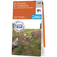
👉 Check Latest PriceThe OS Explorer map of Sevenoaks and Tonbridge, including Royal Tunbridge Wells and Westerham. This map covers three Areas of Outstanding Natural Beauty: the Kent Downs, High Weald, and the Surrey Hills.Explorer 147 shows part of the North Downs Way which passes through north of Sevenoaks. Other highlights include: the stunning Royal Tunbridge Wells, the tranquil Rivers Eden and Medway, and Bough Beech Reservoir — a haven for wildlife.Our Explorer maps are perfect for day-tripping, extensive hikes, and cycling. They come in both standard and Weatherproof Active — so you'll never get caught out in a storm. This map also comes with a free digital download, so you can access it across your devices, making for a convenient companion. Standard Publication Date: 18/03/2024 Weatherproof Publication Date: 14/06/2024