Ordnance Survey
Showing 250 of 1,000 products · GB store
Show a different selection · All stores

Ordnance Survey Pathfinder 100 Outstanding British Walks - OS Guides
£19.99
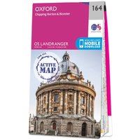
Ordnance Survey OS Map of Oxford: Landranger 164
£16.99

Ordnance Survey OS Map of Newquay & Bodmin: Landranger 200
£16.99

Ordnance Survey OS Map of Kingston Upon Hull & Beverley: Explorer 293
£16.99

Ordnance Survey Ireland Official Road Atlas Ireland
£14.99

Pathfinder Somerset and the Mendips - Pathfinder Guidebook 76
£12.99

OS Map of Norfolk Coast West
£16.99

Ordnance Survey OS Map of Nairn & Forres: Landranger 27 - Weatherproof
£16.99

OS Map of Loch Lomond South: Explorer OL38
£12.99

Ordnance Survey OS Map of Inverness, Loch Ness & Culloden: Explorer 416
£12.99

Ordnance Survey OS Map of Cheltenham & Cirencester: Landranger 163
£16.99

Ordnance Survey Greater London One Inch to One Mile 1971 - Flat Map
£19.99

Ordnance Survey OS Map of Nithsdale & Annandale: Landranger 78
£12.99

Ordnance Survey OS Map of Orkney - Sanday, Eday, North Ronaldsay & Stronsay: Explorer 465
£16.99

Ordnance Survey OS Map of Presteigne & Hay-on-wye: Landranger 148
£16.99

Ordnance Survey OS Map of Rannoch Moor & Ben Alder: Explorer 385
£16.99

Ordnance Survey OS Map of Sudbury, Hadleigh & Dedham Vale: Explorer 196
£16.99

OS Map of Gower: Explorer 164 - Weatherproof
£12.99

Ordnance Survey OS Map of Land's End & Isles of Scilly: Landranger 203
£16.99

Ordnance Survey OS Map of Quantock Hills & Bridgwater: Explorer 140 - Standard
£12.99

Ordnance Survey OS Map of Stratford-upon-avon: Landranger 151
£12.99

Ordnance Survey OS Map of Glenluce & Kirkcowan: Explorer 310
£16.99
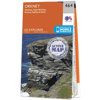
Ordnance Survey OS Map of Orkney - Westray, Papa Westray, Rousay, Egilsay & Wyre: Explorer 464
£16.99

Ordnance Survey OS Map of Bideford, Ilfracombe & Barnstaple: Explorer 139 - 1 Inch To 1 Mile 1:63 360 Scale
£12.99

Ordnance Survey Great Britain's National Parks Relief Map
£14.99

Ordnance Survey Ireland Map of Lough Derg: OSI Adventure Series
£16.99
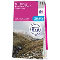
Ordnance Survey OS Map of Nithsdale & Annandale: Landranger 78
£16.99

Ordnance Survey OS Map of Clwydian Range: Explorer 265
£12.99

Ordnance Survey OS Map of Brighton & Lewes: Landranger 198
£12.99

Ordnance Survey OS Map of Orkney - East Mainland: Explorer 461
£12.99

Ordnance Survey Cairngorms Tourist Map 1964 - Flat Map
£19.99

Ordnance Survey OS Map of Annandale Map: Explorer 322 - Weatherproof - 1 Inch To 1 Mile 1:25 000 Scale
£16.99

Ordnance Survey OS Map of Dunbar & North Berwick: Explorer 351
£16.99

Ordnance Survey OS Map of Haltwhistle & Brampton: Landranger 86
£12.99

Ordnance Survey OS Map of Gloucester, Cheltenham & Stroud: Explorer 179 - Weatherproof
£16.99

Ordnance Survey Dartmoor Tourist Map 1973 - Flat Map
£19.99

UCO South West England Short Walks Made Easy Guidebook Set - OS Walking Guides
£50.94

Ordnance Survey OS Map of Bideford, Ilfracombe & Barnstaple: Explorer 139 - 1 Inch To 1 Mile 1:63 360 Scale
£16.99

Ordnance Survey OS Map of Maidstone & The Medway Towns: Explorer 148 - Standard
£12.99

Ordnance Survey OS Map of North Skye: Landranger 23
£12.99

Ordnance Survey OS Map of Woodbridge & Saxmundham: Explorer 212
£12.99

Ordnance Survey OS Map of Rùm, Eigg, Muck & Canna: Landranger 39
£16.99

Ordnance Survey OS Map of Maidstone & Royal Tunbridge Wells: Landranger 188
£12.99

Ordnance Survey OS Map of Scarborough, Bridlington & Flamborough Head: Explorer 301
£16.99

Ordnance Survey OS Map of Knighton & Presteigne: Explorer 201
£12.99

Ordnance Survey OS Map of Loch Alsh, Glen Shiel & Loch Hourn: Landranger 33
£16.99

Ordnance Survey Pathfinder North Yorkshire: Accessible Walks for All - OS Guides
£12.99

Ordnance Survey OS Map of Crewe & Nantwich: Explorer 257
£16.99

Ordnance Survey OS Map of Newport Pagnell & Northampton South: Explorer 207
£16.99

Ordnance Survey OS Map of Oxford - Witney & Woodstock: Explorer 180 - Weatherproof
£12.99

Ordnance Survey OS Map of Llanidloes & Newtown: Explorer 214
£12.99

Pathfinder East Midlands Pathfinder Guidebook Set - OS Walking Guides
£20.78
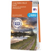
Ordnance Survey OS Map of Chiltern Hills East: Explorer 172 - Weatherproof
£16.99

Ordnance Survey OS Map of Winchester: Explorer OL32 - Weatherproof
£12.99

Ordnance Survey OS Map of North Uist & Berneray: Explorer 454 - Standard - 2 1/2 Inch To 1 Mile 1:25 000 Scale
£12.99

Ordnance Survey OS Map of Kyle of Lochalsh, Plockton & Applecross: Explorer 428
£16.99

Ordnance Survey OS Map of Huntly & Cullen: Explorer 425
£12.99

Ordnance Survey OS Map of Cardigan & Mynydd Preseli: Landranger 145 - Weatherproof
£16.99

Ordnance Survey OS Map of Kelso & Coldstream: Landranger 74
£12.99

Ordnance Survey OS Map of Newcastle Upon Tyne: Explorer 316 - Weatherproof - 2 1/2 Inch To 1 Mile 1:25 000 Scale
£16.99

OS Map of The Cotswolds
£12.99

Ordnance Survey OS Map of Strathdon & Alford: Landranger 37
£16.99

Ordnance Survey OS Map of Rùm, Eigg, Muck & Canna: Landranger 39
£12.99

Ordnance Survey OS Map of Dumfries & Dalbeattie: Explorer 313
£12.99

Ordnance Survey OS Map of Buckingham & Milton Keynes: Explorer 192
£12.99

Ordnance Survey OS Map of Birmingham: Explorer 220
£12.99

OS Pembrokeshire Coast Relief Map
£14.99

Ordnance Survey OS Map of Coigach & Summer Isles: Explorer 439
£16.99
Ordnance Survey OS Map of Southport & Chorley: Explorer 285
£16.99

Ordnance Survey OS Map of Northallerton & Thirsk: Explorer 302
£12.99

Ordnance Survey OS Map of Stratford-upon-avon: Landranger 151
£16.99

Ordnance Survey OS Map of Shetland - Mainland North East: Explorer 468
£16.99

Ordnance Survey OS Map of Bude, Boscastle & Tintagel: Explorer 111
£12.99
Ordnance Survey OS Map of Edge Hill & Fenny Compton: Explorer 206 - Weatherproof - 2 1/2 Inch To 1 Mile 1:25 000 Scale
£16.99

Ordnance Survey OS Map of Bannau Brycheiniog (Brecon Beacons): Landranger 160
£12.99

Ordnance Survey OS Map of Aylesbury & Leighton Buzzard: Landranger 165
£16.99

Ordnance Survey OS Map of Forfar, Brechin & Edzell: Explorer 389
£16.99

Ordnance Survey OS Map of Chelmsford & The Rodings: Explorer 183 - Weatherproof
£16.99

Ordnance Survey OS Map of Glen Cassley & Oykel: Explorer 440 - Standard - 2 1/2 Inch To 1 Mile 1:25 000 Scale
£12.99

Pathfinder Walks in Kent - Pathfinder Guidebook 8
£12.99

Ordnance Survey OS Map of South Skye & Cuillin Hills: Landranger 32
£16.99

Ordnance Survey OS Map of Loch Lomond South: Explorer OL38 - Waterproof
£16.99

Ordnance Survey OS Map of Greenock, Largs & Millport: Explorer 341
£12.99

Ordnance Survey OS Map of Berwick-upon-tweed: Explorer 346
£12.99

Ordnance Survey Yorkshire Dales Relief Map
£14.99

Ordnance Survey OS Map of Dorking, Box Hill & Reigate: Explorer 146 - Weatherproof
£16.99

Ordnance Survey OS Map of St Andrews: Landranger 59
£16.99

Ordnance Survey Pathfinder Aberdeen & Royal Deeside Walking Guidebook - OS Guides 46
£12.99

Ordnance Survey OS Map of Blairgowrie, Kirriemuir & Glamis: Explorer 381
£16.99

Ordnance Survey OS Map of Nottingham: Explorer 260
£12.99

Ordnance Survey OS Map of The Solent & Isle of Wight: Landranger 196
£12.99

Ordnance Survey OS Map of Ayr, Kilmarnock & Troon: Landranger 70 - Weatherproof
£16.99

Ordnance Survey OS Map of The National Forest: Explorer 245
£16.99

Ordnance Survey OS Map of Ipswich & The Naze: Landranger 169 - Weatherproof - 1 1/4 Inch To 1 Mile 1:50 000 Scale
£16.99

Ordnance Survey OS Map of Forfar, Brechin & Edzell: Explorer 389
£12.99

Ordnance Survey OS Map of Foinaven, Arkle, Kylesku & Scourie: Explorer 445 - Weatherproof
£16.99

Ordnance Survey OS Map of Barnstaple & Ilfracombe: Landranger 180
£12.99

Ordnance Survey OS Map of West Cumbria: Landranger 89
£16.99
Ordnance Survey OS Map of Durham & Sunderland: Explorer 308
£12.99

Ordnance Survey OS Map of Lochnagar, Glen Muick & Clova: Explorer OL53 - Waterproof
£16.99

Ordnance Survey OS Map of Cheviot Hills & Kielder Water: Landranger 80
£16.99
Ordnance Survey OS Map of Exmoor: Explorer OL9 - Waterproof
£16.99

Ordnance Survey OS Map of Skegness, Alford & Spilsby: Explorer 274
£16.99

OS Outstanding Walks Lake District - OS Walking Guidebook
£25.00

Ordnance Survey OS Map of Banff & Huntly: Landranger 29
£16.99
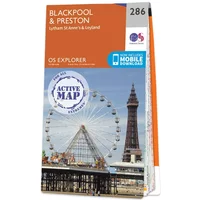
Ordnance Survey OS Map of Blackpool & Preston: Explorer 286
£16.99

Ordnance Survey OS Map of Bourne & Heckington: Explorer 248 - Standard - 2 1/2 Inch To 1 Mile 1:25 000 Scale
£12.99

Ordnance Survey Northumberland Relief Map - A3
£14.99

Ordnance Survey OS Map of Buckie & Keith: Explorer 424
£12.99

Ordnance Survey OS Map of Bourne & Heckington: Explorer 248
£16.99

Ordnance Survey OS Map of High Weald: Explorer 136 - Weatherproof
£16.99

Ordnance Survey OS Map of Morpeth & Blyth: Explorer 325
£16.99

Ordnance Survey OS Map of Bedford & Huntingdon: Landranger 153
£12.99

Ordnance Survey OS Map of Wye Valley & Forest of Dean: Explorer OL14
£16.99

Ordnance Survey North York Moors Relief Map - A3
£14.99

Ordnance Survey OS Map of Shrewsbury & Oswestry: Landranger 126
£16.99

Ordnance Survey OS Map of Carmarthen & Kidwelly: Explorer 177 - Weatherproof
£16.99

Ordnance Survey OS Map of Newmarket & Haverhill: Explorer 210 - Standard
£12.99

Ordnance Survey The Broads Relief Map - A3
£14.99

Ordnance Survey OS Map of Forest of Bowland: Explorer OL41
£12.99

Ordnance Survey OS Map of Glasgow: Landranger 64
£16.99

Ordnance Survey OS Map of Basingstoke: Explorer 144 - Waterproof
£16.99

Ordnance Survey OS Map of Kirkcudbright & Castle Douglas: Explorer 312
£16.99
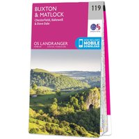
Ordnance Survey OS Map of Buxton & Matlock: Landranger 119
£12.99

Ordnance Survey OS Map of Harlech, Porthmadog & Y Bala: Explorer OL18 - Weatherproof
£16.99

Ordnance Survey OS Map of Carlisle: Explorer 315
£12.99

Ordnance Survey OS Map of Glasgow Paisley, Rutherglen & Kirkintilloch: Explorer 342
£16.99

Ordnance Survey OS Map of The Lake District: South-eastern Area: Explorer OL7
£12.99

Ordnance Survey OS Map of Jura & Colonsay: Landranger 61
£12.99

Ordnance Survey Northumberland Walking Guidebook Set - OS Walking Guides
£17.58

Ordnance Survey OS Map of Lochgilphead & Knapdale North: Explorer 358
£16.99

Ordnance Survey OS Map of Nottingham & Loughborough: Landranger 129
£12.99

Pathfinder Walks in Staffordshire - Pathfinder Guidebook 81
£12.99

Ordnance Survey OS Map of Newbury & Wantage: Landranger 174
£12.99

Ordnance Survey OS Map of Cambridge & Newmarket: Landranger 154
£16.99

Ordnance Survey OS Map of Newbury & Wantage: Landranger 174
£16.99

Ordnance Survey OS Map of Abingdon, Wantage & Vale of White Horse: Explorer 170 - Weatherproof
£12.99

Ordnance Survey OS Map of Oban, Kerrera & Loch Melfort: Explorer 359
£16.99

OS Map of Snowdon (Yr Wyddfa) - Caernarfon: Landranger 115 - Weatherproof - 1 1/4 Inch To 1 Mile 1:50 000 Scale
£16.99

Ordnance Survey Pathfinder Walks in Yorkshire Dales Guidebook 15
£12.99

Ordnance Survey OS Map of Reading: Explorer 159
£12.99

Ordnance Survey OS Map of Rugby & Daventry: Explorer 222
£12.99

Ordnance Survey OS Map of Hastings & Bexhill: Explorer 124
£16.99

Garmin Yr Wyddfa (Snowdon) One Inch to One Mile 1962 - Flat Map
£19.99

Ordnance Survey OS Map of Durham & Sunderland: Explorer 308
£16.99

Ordnance Survey OS Map of Salisbury & The Plain: Landranger 184
£12.99

Ordnance Survey Pathfinder Fort William & Glen Coe - OS Guides 7
£12.99

Ordnance Survey OS Map of Colchester: Landranger 168
£16.99

OS Map of North Pennines
£12.99

Ordnance Survey OS Map of Lochindorb, Grantown-on-Spey & Carrbridge: Explorer OL60 - Waterproof
£16.99

OS Map of The Peak District - Dark Peak Area
£16.99

Ordnance Survey OS Map of Doncaster: Explorer 279
£16.99

Ordnance Survey OS Map of Kettering & Corby: Landranger 141
£16.99

Ordnance Survey OS Map of Arbroath, Montrose & Carnoustie: Explorer 382
£16.99

Ordnance Survey OS Map of Whitehaven & Workington: Explorer 303
£16.99

Ordnance Survey OS Map of Aberystwyth & Machynlleth: Landranger 135 - Weatherproof
£16.99

Ordnance Survey OS Map of Winchester: Explorer OL32 - Weatherproof
£16.99

Ordnance Survey OS Map of Sheffield & Huddersfield: Landranger 110
£16.99

Ordnance Survey OS Map of Consett & Derwent Reservoir: Explorer 307
£16.99

Ordnance Survey OS Map of Anglesey (ynys Môn): Landranger 114
£12.99

Ordnance Survey OS Map of Newcastle Emlyn: Explorer 185 - Weatherproof
£12.99

Ordnance Survey OS Map of Isle Of Axholme: Explorer 280 - Weatherproof
£12.99

Ordnance Survey OS Map of Southend-on-Sea & Basildon: Explorer 175 - Weatherproof
£12.99

Ordnance Survey OS Map of Bedford & St Neots: Explorer 208
£16.99

Ordnance Survey OS Map of Elgin & Dufftown Map: Landranger 28 - Weatherproof - 1 Inch To 1 Mile 1:50 000 Scale
£16.99

Ordnance Survey OS Map of Lyme Regis & Bridport: Explorer 116
£12.99

Ordnance Survey OS Map of Gairloch & Loch Ewe: Explorer 434 - Weatherproof
£16.99

Ordnance Survey OS Map of Wick & The Flow Country: Explorer 450
£12.99

Ordnance Survey OS Map of Cardiff & Newport: Landranger 171
£12.99

Ordnance Survey OS Map of Newtown & Machynlleth: Explorer 215
£12.99

Ordnance Survey Pathfinder Walks in Cambridgeshire & the Fens Guidebook 51
£12.99

Ordnance Survey OS Map of Cheltenham & Cirencester: Landranger 163
£12.99

Ordnance Survey Pathfinder Lancashire - OS Guides 53
£12.99

Ordnance Survey Ireland Map of Wicklow South: OSI Adventure Series
£16.99

Ordnance Survey OS Map of Crawley & Horsham: Explorer OL34 - Weatherproof
£12.99

Ordnance Survey OS Map of Ben Wyvis & Strathpeffer: Explorer 437
£12.99

Ordnance Survey OS Map of Salisbury & Stonehenge: Explorer 130
£16.99

Ordnance Survey OS Map of Reading & Windsor: Landranger 175 - Weatherproof - 1 1/4 Inch To 1 Mile 1:50 000 Scale
£16.99

Ordnance Survey OS Map of Barnard Castle & Richmond: Landranger 92
£12.99

Ordnance Survey OS Map of Malvern Hills & Bredon Hill: Explorer 190
£12.99
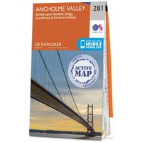
Ordnance Survey OS Map of Ancholme Valley: Explorer 281
£16.99

Ordnance Survey OS Map of Birmingham: Explorer 220 - Weatherproof - 2 1/2 Inch To 1 Mile 1:25 000 Scale
£16.99

Ordnance Survey OS Map of Loch Tay & Glen Dochart: Landranger 51
£16.99

Ordnance Survey OS Map of Stirling & The Trossachs: Landranger 57
£16.99

Ordnance Survey OS Map of Stoke-on-trent & Macclesfield: Landranger 118
£12.99
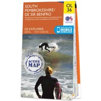
Ordnance Survey OS Map of South Pembrokeshire: Explorer OL36
£16.99

Ordnance Survey OS Map of Banbury, Bicester & Chipping Norton: Explorer 191 - Standard
£12.99

OS Map of Presteigne & Hay-on-Wye: Landranger 148 - Standard - 1 1/4 Inch To 1 Mile 1:50 000 Scale
£12.99

Ordnance Survey OS Map of Chiltern Hills West: Explorer 171 - Weatherproof
£12.99

Ordnance Survey OS Map of Minehead & Brendon Hills: Landranger 181 - Standard - 1 1/4 Inch To 1 Mile 1:50 000 Scale
£12.99

Ordnance Survey OS Map of Shaftesbury & Cranborne Chase: Explorer 118
£16.99

Ordnance Survey OS Map of Dornoch & Tain: Explorer 438
£16.99

Ordnance Survey OS Map of Skye - Trotternish & The Storr: Explorer 408
£12.99

Ordnance Survey OS Map of Lower Wharfedale & Washburn Valley: Explorer 297 - Weatherproof - 2 1/2 Inch To 1 Mile 1:25 000 Scale
£16.99
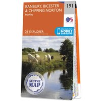
Ordnance Survey OS Map of Banbury, Bicester & Chipping Norton: Explorer 191
£16.99
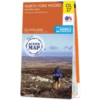
Ordnance Survey OS Map of North York Moors - Eastern Area: Explorer OL27 - Weatherproof
£16.99

Ordnance Survey OS Map of Ely & Newmarket: Explorer 226 - Standard
£12.99

Ordnance Survey OS Map of Shrewsbury: Explorer 241
£12.99

Ordnance Survey OS Map of Lowther Hills, Sanquhar & Leadhills: Explorer 329 - Standard
£12.99

Ordnance Survey OS Map of Hereford & Ross-on-wye: Explorer 189
£12.99

Ordnance Survey OS Map of Thames Estuary: Landranger 178
£12.99

Ordnance Survey OS Map of Aboyne, Alford & Strathdon: Explorer OL59 - Waterproof
£16.99

Ordnance Survey OS Map of Llandeilo & Brechfa Forest: Explorer 186 - Weatherproof
£16.99

Ordnance Survey OS Map of Black Isle: Explorer 432
£16.99

Ordnance Survey OS Map of Kielder Water & Forest: Explorer OL42
£12.99

OS The Complete Set of Puzzle Books
£67.96

Ordnance Survey OS Map of Shetland - Mainland Central: Explorer 467
£12.99

Ordnance Survey OS Map of Glen Orchy & Loch Etive: Landranger 50
£12.99

Ordnance Survey OS Map of Middlesbrough & Hartlepool: Explorer 306
£16.99

Ordnance Survey OS Map of Atholl: Explorer OL51
£16.99

Ordnance Survey OS Map of Northallerton & Thirsk: Explorer 302
£16.99

Ordnance Survey OS Map of The Long Mynd & Wenlock Edge: Explorer 217
£12.99

Ordnance Survey OS Map of Oxford: Landranger 164
£12.99

Ordnance Survey OS Map of Aylesbury & Leighton Buzzard: Landranger 165 - Standard - 1 1/4 Inch To 1 Mile 1:50 000 Scale
£12.99

Ordnance Survey OS Map of Porthmadog & Dolgellau: Landranger 124
£16.99

UCO Cairngorms Walking Guidebook Set - OS Walking Guides
£15.98

Ordnance Survey Pathfinder Walks in Gower, Swansea & Cardiff Guidebook 55
£12.99

Ordnance Survey OS Map of Grimsby, Cleethorpes & Immingham: Explorer 284
£12.99

Ordnance Survey OS Map of Cardiff & Bridgend: Explorer 151 - Standard
£12.99

Pathfinder North West Pathfinder Guidebook Set - OS Walking Guides
£77.94
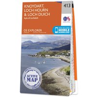
Ordnance Survey OS Map of Knoydart, Loch Hourn & Loch Duich: Explorer 413
£16.99

Ordnance Survey OS Map of Exmouth & Sidmouth: Explorer 115
£16.99

Ordnance Survey OS Map of Shetland - Unst, Yell & Fetlar: Explorer 470
£16.99

Ordnance Survey OS Map of Chelmsford: Landranger 167
£16.99

Ordnance Survey OS Map of Parc Cenedlaethol Bannau Brycheiniog (brecon Beacons National Park) - Eastern Area
£12.99

OS Map of Grantown & Aviemore: Landranger 36 - Standard - 1 1/4 Inch To 1 Mile 1:50 000 Scale
£12.99

Garmin Cardiff One Inch to One Mile 1972 - Flat Map
£19.99

Ordnance Survey OS Map of Pentland Hills: Explorer 344
£16.99

Ordnance Survey Ireland Map of Wicklow North: OSI Adventure Series
£16.99

Ordnance Survey OS Map of Peterhead & Fraserburgh: Explorer 427
£16.99

Ordnance Survey OS Map of Bristol & Bath Keynsham & Marshfield: Explorer 155 - 1 Inch To 1 Mile 1:63 360 Scale
£16.99

Ordnance Survey OS Map of Chichester & the South Downs: Landranger 197
£16.99

Ordnance Survey OS Map of Peterborough: Explorer 227
£16.99

Ordnance Survey The Complete Set of Dog-friendly Walks Made Easy Guidebooks - OS Short Walks Made Easy
£21.57

Ordnance Survey OS Map of Llandrindod Wells & Elan Valley: Explorer 200
£12.99

Ordnance Survey OS Map of Cadair Idris & Bala Lake: Explorer OL23
£12.99

Ordnance Survey Eryri (Snowdonia) Relief Map - A3
£14.99

Ordnance Survey OS Map of Firth of Clyde: Landranger 63
£16.99

Ordnance Survey OS Map of Winchester & Basingstoke: Landranger 185
£16.99

Ordnance Survey OS Map of Lake Vyrnwy & Llanfyllin: Explorer 239
£16.99

Ordnance Survey Ben Nevis & Glen Coe Tourist Map 1967 - Flat Map
£19.99

UCO South Downs Walking Guidebook Set - OS Walking Guides
£27.97

Ordnance Survey OS Map of Nairn & Cawdor: Explorer 422
£16.99

Ordnance Survey OS Map of Dover, Folkestone & Hythe: Explorer 138 - Weatherproof
£16.99

Ordnance Survey Pathfinder Lincolnshire & The Wolds - OS Guides 50
£12.99

Ordnance Survey OS Map of Leeds & Bradford: Landranger 104
£16.99

Ordnance Survey OS Map of Woodbridge & Saxmundham: Explorer 212
£16.99
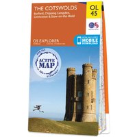
Ordnance Survey OS Map of The Cotswolds: Explorer OL45
£16.99

Ordnance Survey OS Map of Sittingbourne & Faversham: Explorer 149 - Standard
£12.99

OS The Complete Set of Short Walks Made Easy Guidebooks - England
£174.54